MyTopo
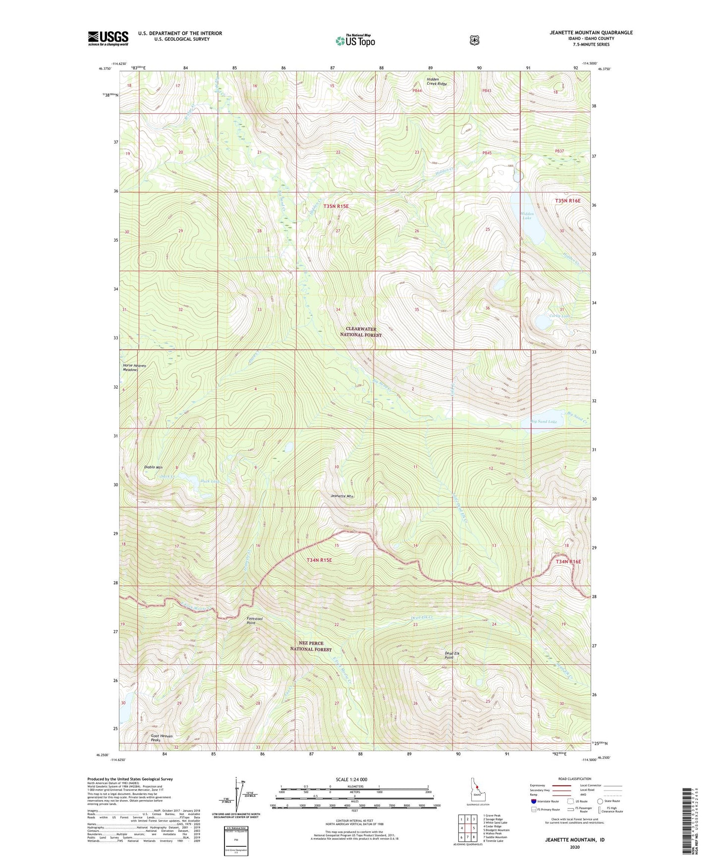
Jeanette Mountain Idaho US Topo Map
Couldn't load pickup availability
Also explore the Jeanette Mountain Forest Service Topo of this same quad for updated USFS data
2024 topographic map quadrangle Jeanette Mountain in the state of Idaho. Scale: 1:24000. Based on the newly updated USGS 7.5' US Topo map series, this map is in the following counties: Idaho. The map contains contour data, water features, and other items you are used to seeing on USGS maps, but also has updated roads and other features. This is the next generation of topographic maps. Printed on high-quality waterproof paper with UV fade-resistant inks.
Quads adjacent to this one:
West: Cedar Ridge
Northwest: Grave Peak
North: Savage Ridge
Northeast: White Sand Lake
East: Blodgett Mountain
Southeast: Tenmile Lake
South: Saddle Mountain
Southwest: Wahoo Peak
This map covers the same area as the classic USGS quad with code o46114c5.
Contains the following named places: Big Sand Lake, Boyd Lake, Bridge Creek, Chute Creek, Cold Creek, Corky Lake, Cox Creek, Dead Elk Creek, Dead Elk Point, Diablo Mountain, Duck Creek, Duck Lake, Footstool Point, Goat Lakes, Hidden Creek, Hidden Lake, Jeanette Creek, Jeanette Lake, Jeanette Mountain, Little Dead Elk Creek, Poacher Creek