
MyTopo
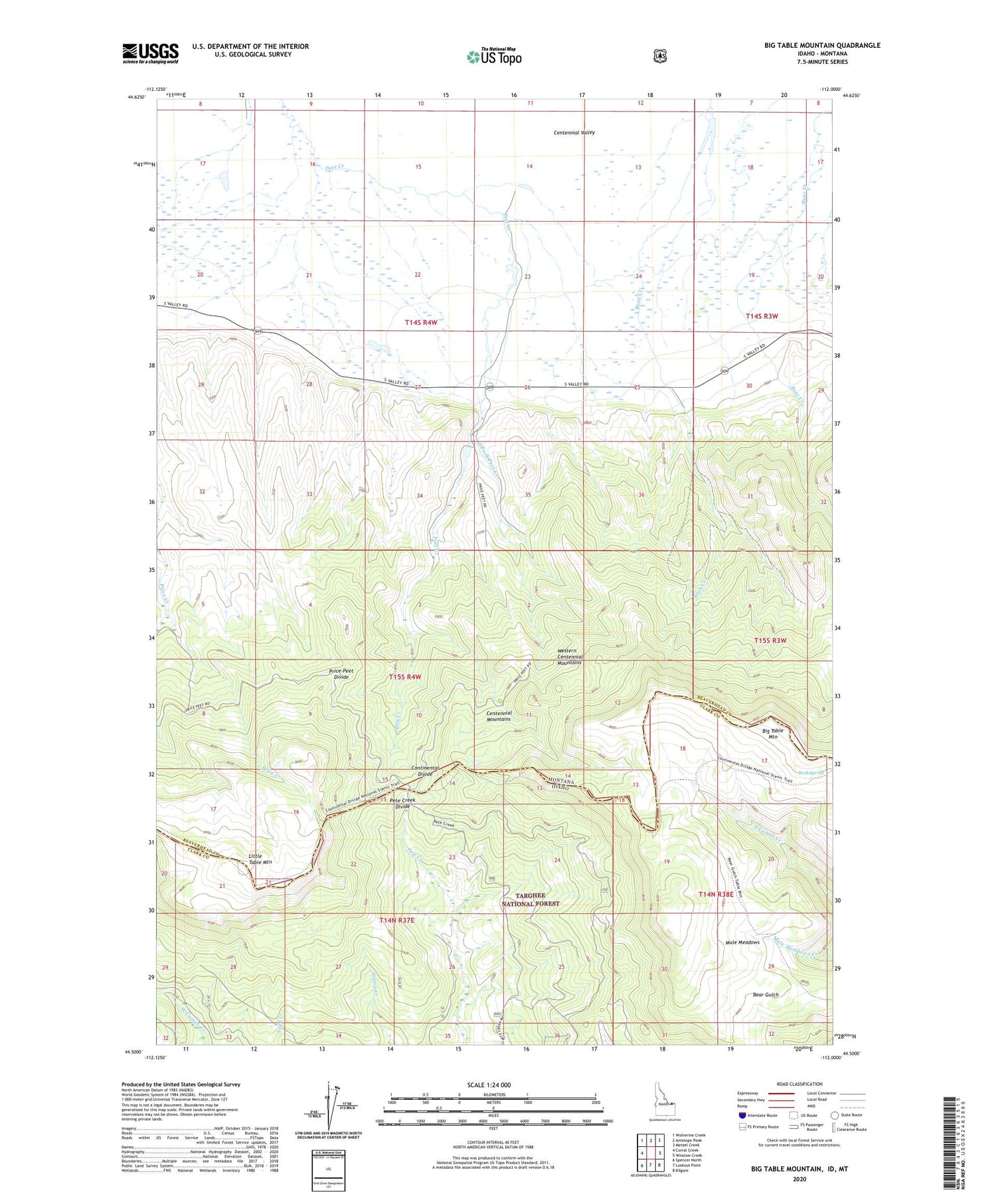
Big Table Mountain Idaho US Topo Map
Couldn't load pickup availability
Also explore the Big Table Mountain Forest Service Topo of this same quad for updated USFS data
2024 topographic map quadrangle Big Table Mountain in the states of Montana, Idaho. Scale: 1:24000. Based on the newly updated USGS 7.5' US Topo map series, this map is in the following counties: Clark, Beaverhead. The map contains contour data, water features, and other items you are used to seeing on USGS maps, but also has updated roads and other features. This is the next generation of topographic maps. Printed on high-quality waterproof paper with UV fade-resistant inks.
Quads adjacent to this one:
West: Corral Creek
Northwest: Wolverine Creek
North: Antelope Peak
Northeast: Metzel Creek
East: Winslow Creek
Southeast: Kilgore
South: Lookout Point
Southwest: Spencer North
Contains the following named places: Big Table Mountain, Cactus Dam, Chandelier Dam, East Fork Peet Creek, Jones Ranch, Little Table Mountain, Mule Meadows, Pands Dam, Pete Creek Divide, Price-Peet Divide, Rock Spring, Table Mountain Trail, Western Centennial Mountains


