MyTopo
King Hill Idaho US Topo Map
Couldn't load pickup availability
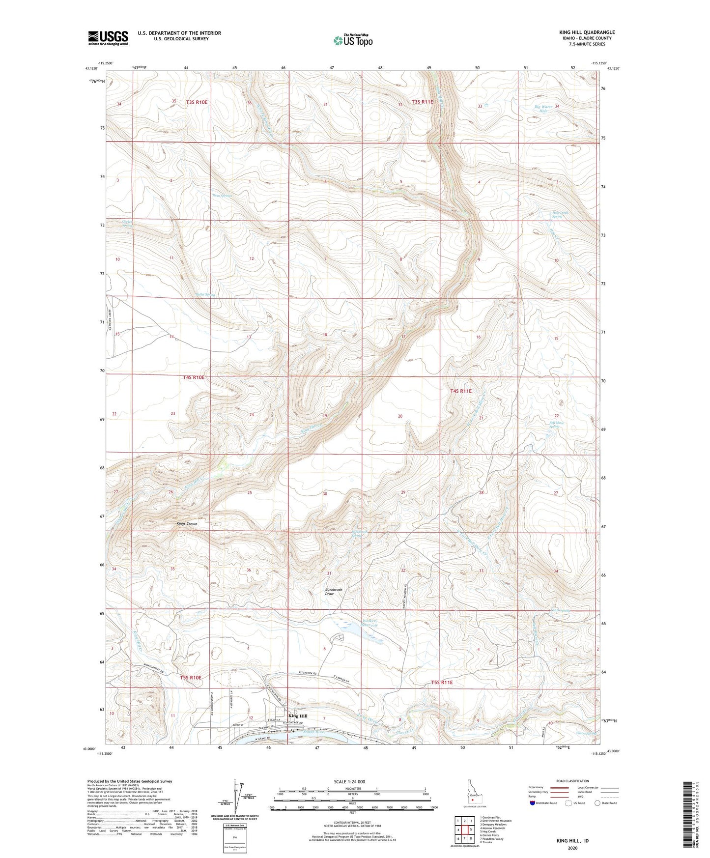
2023 topographic map quadrangle King Hill in the state of Idaho. Scale: 1:24000. Based on the newly updated USGS 7.5' US Topo map series, this map is in the following counties: Elmore. The map contains contour data, water features, and other items you are used to seeing on USGS maps, but also has updated roads and other features. This is the next generation of topographic maps. Printed on high-quality waterproof paper with UV fade-resistant inks.
Quads adjacent to this one:
West: Morrow Reservoir
Northwest: Goodman Flat
North: Deer Heaven Mountain
Northeast: Dempsey Meadows
East: Hog Creek
Southeast: Ticeska
South: Pasadena Valley
Southwest: Glenns Ferry
This map covers the same area as the classic USGS quad with code o43115a2.
Contains the following named places: Bell Mare Creek, Bell Mare Spring, Big Water Hole, Buckbrush Draw, Buckbrush Spring, Bullet Spring, Chalk Spring, Corker Springs, Devils Playground, East Fork Bell Mare Creek, Hog Creek Spring, King Hill, Kings Crown, Ricke Ditch, Twin Springs, Walker Dam, Walker Ditch, Walker Reservoir, Warm Spring, West Fork Bell Mare Creek, West Fork King Hill Creek, ZIP Code: 83633