MyTopo
Pasadena Valley Idaho US Topo Map
Couldn't load pickup availability
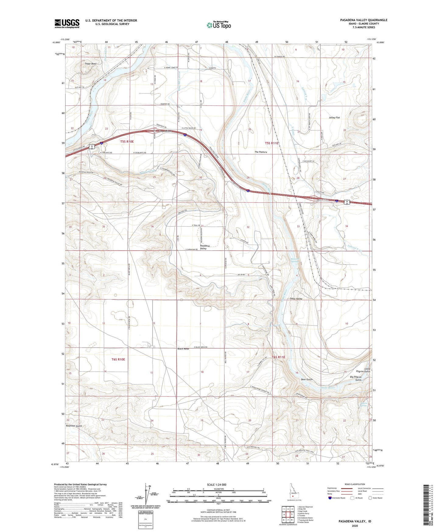
2023 topographic map quadrangle Pasadena Valley in the state of Idaho. Scale: 1:24000. Based on the newly updated USGS 7.5' US Topo map series, this map is in the following counties: Elmore. The map contains contour data, water features, and other items you are used to seeing on USGS maps, but also has updated roads and other features. This is the next generation of topographic maps. Printed on high-quality waterproof paper with UV fade-resistant inks.
Quads adjacent to this one:
West: Glenns Ferry
Northwest: Morrow Reservoir
North: King Hill
Northeast: Hog Creek
East: Ticeska
Southeast: Indian Butte
South: Twentymile Butte
Southwest: Grindstone Butte
This map covers the same area as the classic USGS quad with code o42115h2.
Contains the following named places: Bancroft Springs, Basin Lateral, Basin Siphon, Big Pilgrim Gulch, Black Mesa, Clover Creek, Deer Gulch, Frog Hollow, Jolley Flat, King Hill Creek, King Hill Lateral, Lateral Y-9, Little Pilgrim Gulch, Pasadena Valley, Pasadena Valley School, Pilgrim Spring, Pilgrim Stage Station Historic Site, Sugar Bowl, Sunleaf Siphon, Swiss Valley, The Pasture