MyTopo
Lava Hot Springs Idaho US Topo Map
Couldn't load pickup availability
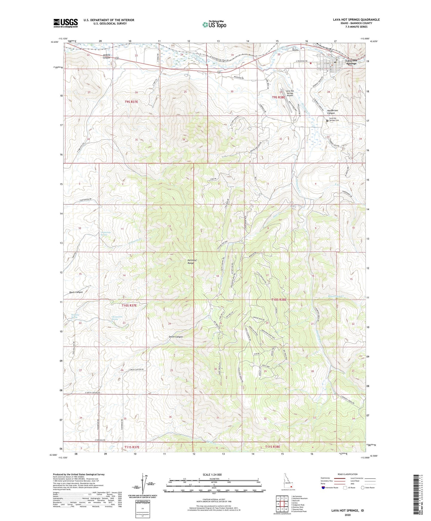
2024 topographic map quadrangle Lava Hot Springs in the state of Idaho. Scale: 1:24000. Based on the newly updated USGS 7.5' US Topo map series, this map is in the following counties: Bannock. The map contains contour data, water features, and other items you are used to seeing on USGS maps, but also has updated roads and other features. This is the next generation of topographic maps. Printed on high-quality waterproof paper with UV fade-resistant inks.
Quads adjacent to this one:
West: Arimo
Northwest: McCammon
North: Haystack Mountain
Northeast: Bancroft
East: Sedgwick Peak
Southeast: Cottonwood Peak
South: Downey East
Southwest: Downey West
Contains the following named places: Beaverdam Creek, Chatterton Spring, Christenson Spring, City of Lava Hot Springs, Davis Canyon, Deer Creek, Dempsey Creek, East Creek, Henderson Canyon, Jenkins Canyon, Lava Elementary School, Lava Hot Springs, Lava Hot Springs Airport, Lava Hot Springs Cemetery, Lava Hot Springs Post Office, Lava Hot Springs Volunteer Fire Department, Smith Canyon, Welcome Spring, Yago Creek Access Area, ZIP Code: 83246