MyTopo
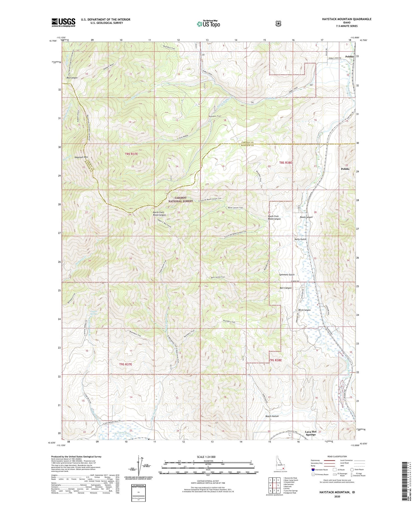
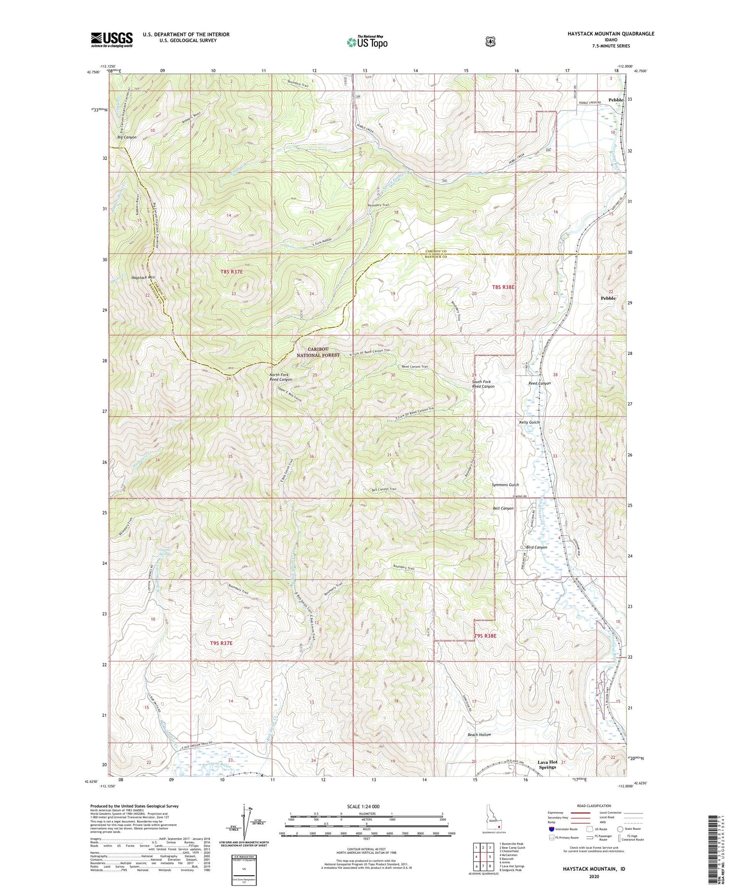
Haystack Mountain Idaho US Topo Map
Couldn't load pickup availability
Also explore the Haystack Mountain Forest Service Topo of this same quad for updated USFS data
2023 topographic map quadrangle Haystack Mountain in the state of Idaho. Scale: 1:24000. Based on the newly updated USGS 7.5' US Topo map series, this map is in the following counties: Bannock, Caribou. The map contains contour data, water features, and other items you are used to seeing on USGS maps, but also has updated roads and other features. This is the next generation of topographic maps. Printed on high-quality waterproof paper with UV fade-resistant inks.
Quads adjacent to this one:
West: McCammon
Northwest: Bonneville Peak
North: Bear Camp Gulch
Northeast: Chesterfield
East: Bancroft
Southeast: Sedgwick Peak
South: Lava Hot Springs
Southwest: Arimo
This map covers the same area as the classic USGS quad with code o42112f1.
Contains the following named places: Beach Hollow, Bell Canyon, Bird Canyon, Blaser Station, Clear Creek, Crystal Springs, East Bob Smith Creek, Haystack Mountain, Kelly Gulch, Lower Portneuf Access Area, North Fork Pebble Creek, North Fork Reed Canyon, Pebble, Pebble Creek, Pebble Siding, Reed Canyon, South Fork Pebble Creek, South Fork Reed Canyon, Symmons Gulch, Topaz, Upper Portneuf Access Area, West Bob Smith Creek