MyTopo
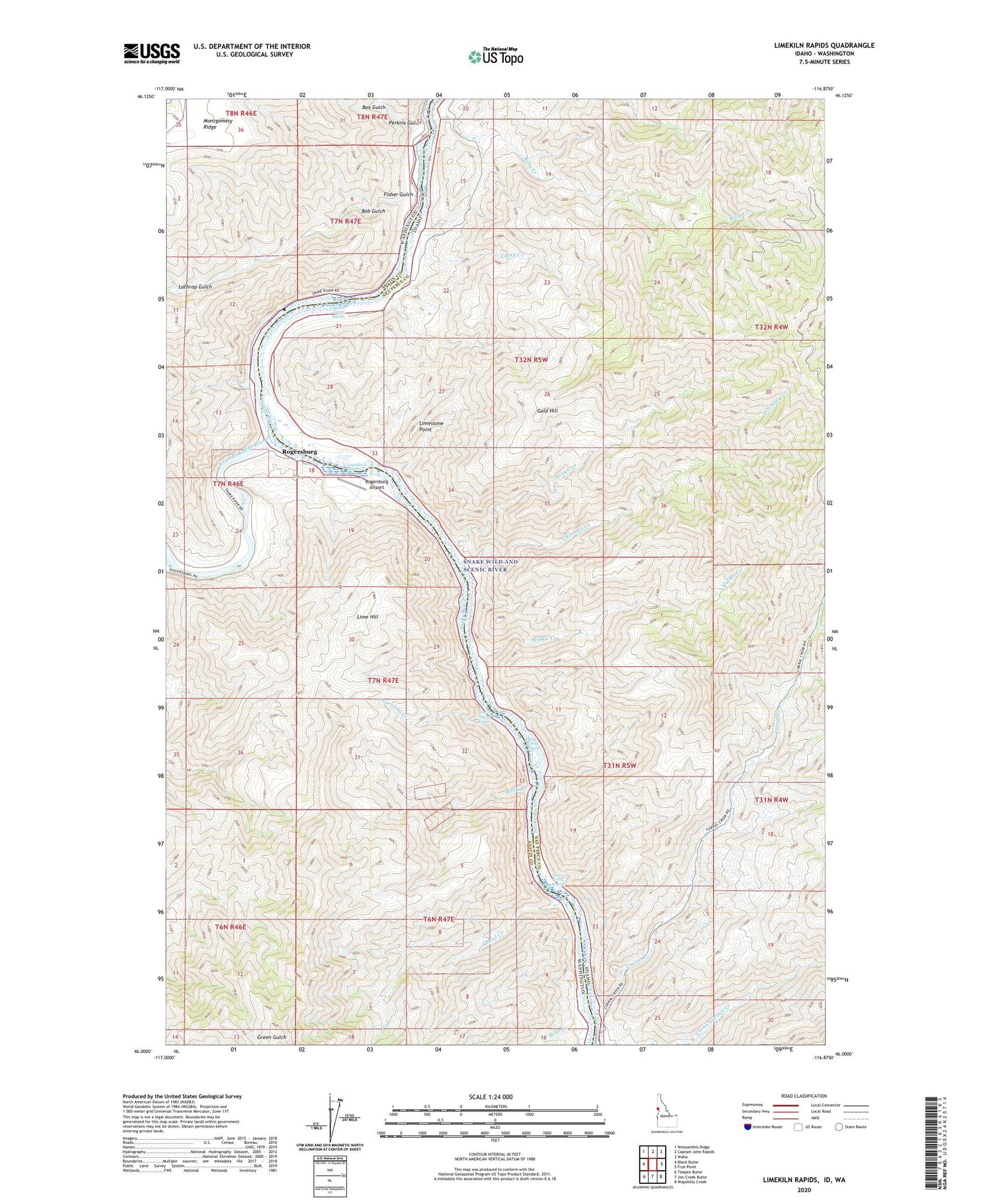
Limekiln Rapids Idaho US Topo Map
Couldn't load pickup availability
Also explore the Limekiln Rapids Forest Service Topo of this same quad for updated USFS data
2024 topographic map quadrangle Limekiln Rapids in the states of Idaho, Washington. Scale: 1:24000. Based on the newly updated USGS 7.5' US Topo map series, this map is in the following counties: Nez Perce, Asotin. The map contains contour data, water features, and other items you are used to seeing on USGS maps, but also has updated roads and other features. This is the next generation of topographic maps. Printed on high-quality waterproof paper with UV fade-resistant inks.
Quads adjacent to this one:
West: Black Butte
Northwest: Weissenfels Ridge
North: Captain John Rapids
Northeast: Waha
East: Frye Point
Southeast: Wapshilla Creek
South: Jim Creek Butte
Southwest: Teepee Butte
Contains the following named places: Anaconda Creek, Bear Bar, Bear Creek, Billy Creek, Birch Creek, Bob Gulch, Box Gulch, Camp Creek, Captain Lewis Rapids, Chimney Creek, Corral Creek, Craig Mountain Wildlife Management Area, Dough Creek, Fisher Gulch, Gold Hill, Grande Ronde River, Lathrop Gulch, Lime Hill, Limekiln Rapids, Limestone Point, Middle Creek, Negro Head Rapids, Perkins Gulch, Rogersburg, Rogersburg Airport, Shovel Creek, Shovel Creek Rapids, Wild Goose Rapids, Zindel