MyTopo
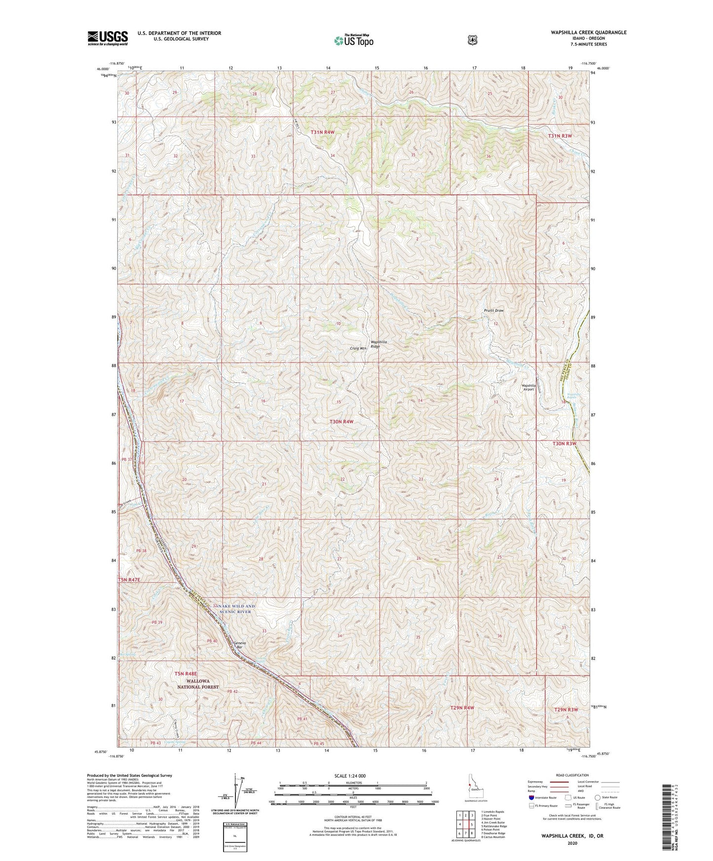
Wapshilla Creek Idaho US Topo Map
Couldn't load pickup availability
Also explore the Wapshilla Creek Forest Service Topo of this same quad for updated USFS data
2024 topographic map quadrangle Wapshilla Creek in the states of Idaho, Oregon. Scale: 1:24000. Based on the newly updated USGS 7.5' US Topo map series, this map is in the following counties: Nez Perce, Wallowa, Idaho. The map contains contour data, water features, and other items you are used to seeing on USGS maps, but also has updated roads and other features. This is the next generation of topographic maps. Printed on high-quality waterproof paper with UV fade-resistant inks.
Quads adjacent to this one:
West: Jim Creek Butte
Northwest: Limekiln Rapids
North: Frye Point
Northeast: Hoover Point
East: Rattlesnake Ridge
Southeast: Cactus Mountain
South: Deadhorse Ridge
Southwest: Poison Point
Contains the following named places: Banks Creek, Birch Creek, Cherry Creek, Cook Creek, Cottonwood Creek, Coyote Spring, Frenchy Creek, Frenchy Rapids, Geneva Bar, Hot Spring, Jim Creek, Lone Pine Creek, Pruitt Draw, Snake Wild and Scenic River, South Fork Birch Creek, Wapshilla Airport, Wapshilla Creek, Wapshilla Rapids, Wapshilla Ridge