MyTopo
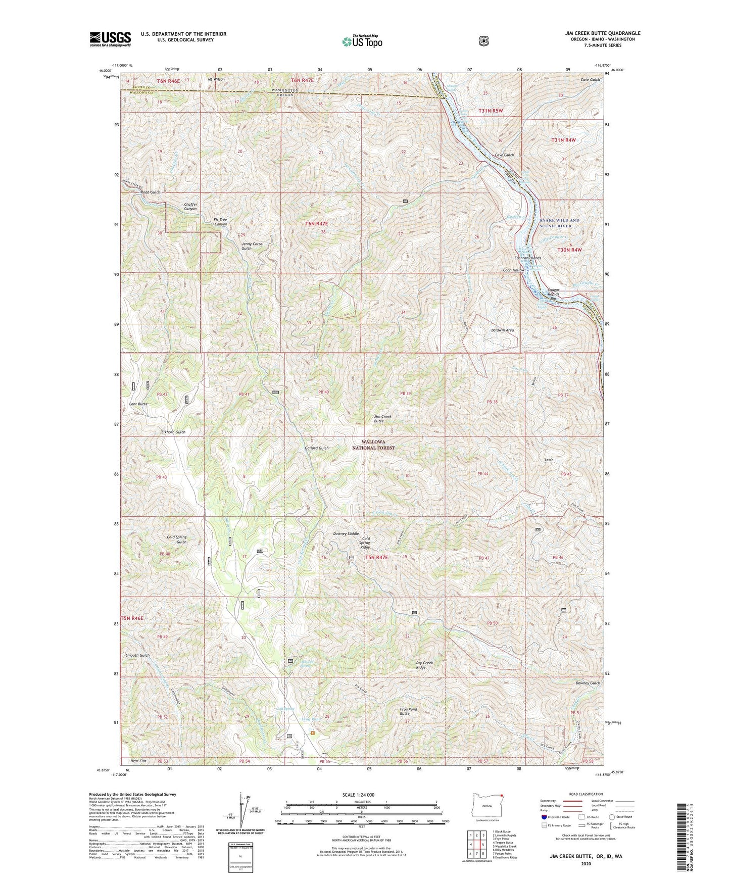
Jim Creek Butte Oregon US Topo Map
Couldn't load pickup availability
Also explore the Jim Creek Butte Forest Service Topo of this same quad for updated USFS data
2023 topographic map quadrangle Jim Creek Butte in the states of Oregon, Idaho, Washington. Scale: 1:24000. Based on the newly updated USGS 7.5' US Topo map series, this map is in the following counties: Wallowa, Nez Perce, Asotin. The map contains contour data, water features, and other items you are used to seeing on USGS maps, but also has updated roads and other features. This is the next generation of topographic maps. Printed on high-quality waterproof paper with UV fade-resistant inks.
Quads adjacent to this one:
West: Teepee Butte
Northwest: Black Butte
North: Limekiln Rapids
Northeast: Frye Point
East: Wapshilla Creek
Southeast: Deadhorse Ridge
South: Poison Point
Southwest: Billy Meadows
Contains the following named places: Baldwin Area, Big Cougar Creek, Cabin Creek, Cache Creek, Cache Creek Ranch Recreation Site, Cache Creek USFS Airport, Cave Gulch, Chaffer Canyon, China Garden, China Garden Creek, Cochran Islands, Cochran Rapids, Cold Spring, Cold Spring Cow Camp, Cold Spring Creek, Cold Spring Ridge, Coon Creek, Coon Hollow, Cougar Rapids, Cougar Rapids Bar, Deadhorse Creek, Downey Gulch, Downey Saddle, Dry Creek, Dry Creek Ridge, Fir Tree Canyon, Frog Pond, Frog Pond Butte, Gailord Gulch, Garden Creek, Jack Lowery Creek, Jenny Corral Gulch, Jim Creek Butte, Jim Creek Ranch, Lent Butte, Little Cougar Creek, Lower Cache Creek Rapids, Lower Cochran Rapids, McDuff Rapids, Mount Wilson, North Fork Jim Creek, Old Cold Spring, Road Gulch, Sheldon Creek, Smooth Gulch, South Fork Jim Creek, Spencer Creek, State Line Creek, Upper Cache Creek Rapids, Upper Cochran Rapids