MyTopo
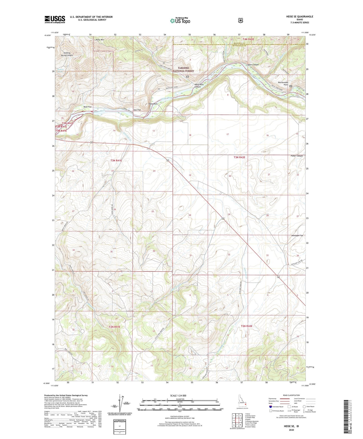
Heise SE Idaho US Topo Map
Couldn't load pickup availability
Also explore the Heise SE Forest Service Topo of this same quad for updated USFS data
2024 topographic map quadrangle Heise SE in the state of Idaho. Scale: 1:24000. Based on the newly updated USGS 7.5' US Topo map series, this map is in the following counties: Bonneville, Madison. The map contains contour data, water features, and other items you are used to seeing on USGS maps, but also has updated roads and other features. This is the next generation of topographic maps. Printed on high-quality waterproof paper with UV fade-resistant inks.
Quads adjacent to this one:
West: Poplar
Northwest: Heise
North: Hawley Gulch
Northeast: Temple Peak
East: Wheaton Mountain
Southeast: Conant Valley
South: Point Lookout
Southwest: Lone Pine Ridge
This map covers the same area as the classic USGS quad with code o43111e5.
Contains the following named places: Antelope Creek, Antelope Creek Ranch, Antelope Flat, Antelope School, Christensen Ranch, Clark Ranch, Goe Flat, Kelly Mountain, Little Pine Creek, Mud Creek, Open Canyon, Petersen Ranch, Rattlesnake Point, Reed Ranch, Spaulding Ranch, Spring Creek, Stinking Spring, Table Rock, Table Rock Canyon, Wheeler Ranch, Wolf Flat, Wolverine Creek, ZIP Code: 83443