MyTopo
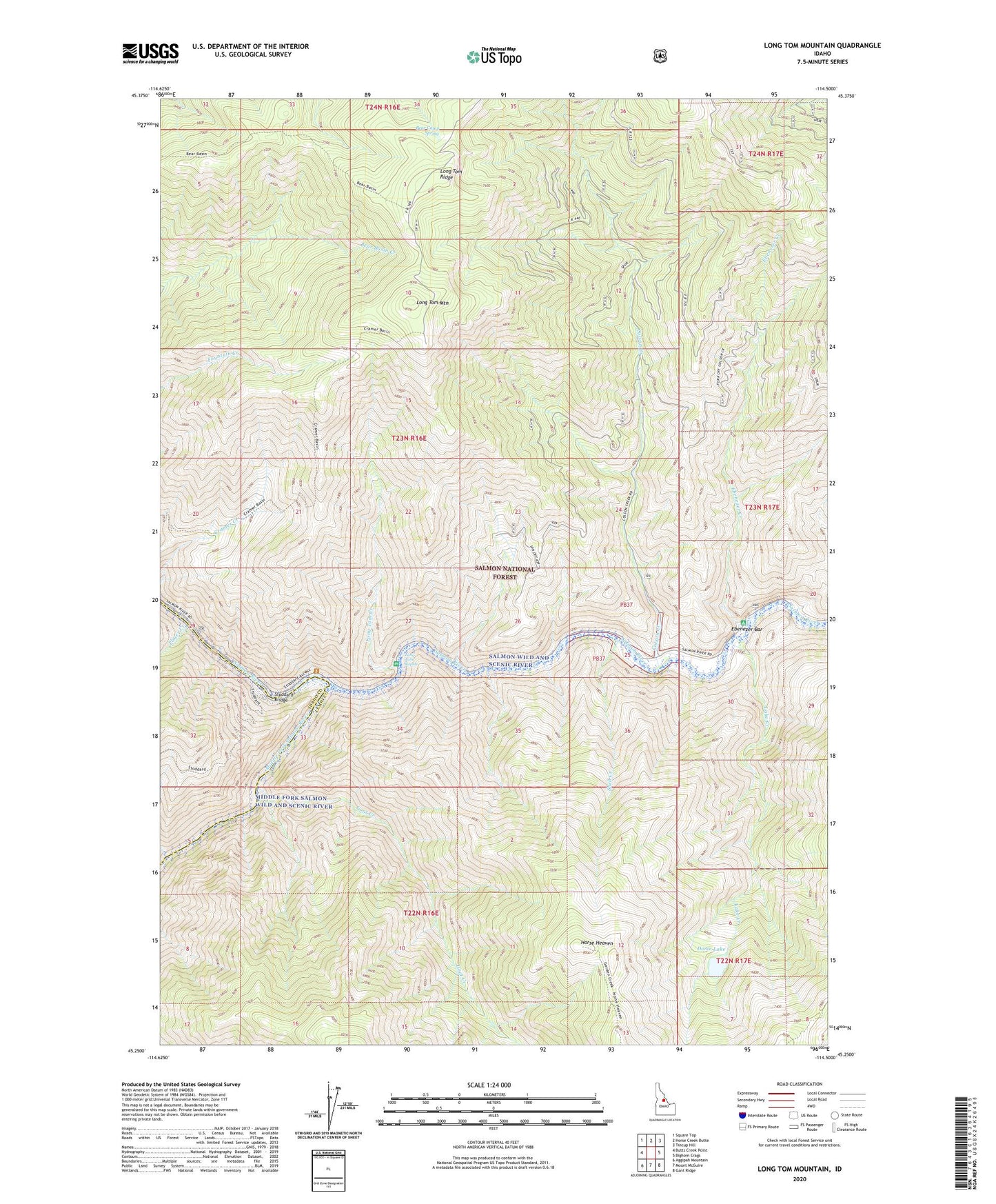
Long Tom Mountain Idaho US Topo Map
Couldn't load pickup availability
Also explore the Long Tom Mountain Forest Service Topo of this same quad for updated USFS data
2024 topographic map quadrangle Long Tom Mountain in the state of Idaho. Scale: 1:24000. Based on the newly updated USGS 7.5' US Topo map series, this map is in the following counties: Lemhi, Idaho. The map contains contour data, water features, and other items you are used to seeing on USGS maps, but also has updated roads and other features. This is the next generation of topographic maps. Printed on high-quality waterproof paper with UV fade-resistant inks.
Quads adjacent to this one:
West: Butts Creek Point
Northwest: Square Top
North: Horse Creek Butte
Northeast: Tincup Hill
East: Bighorn Crags
Southeast: Gant Ridge
South: Mount McGuire
Southwest: Aggipah Mountain
This map covers the same area as the classic USGS quad with code o45114c5.
Contains the following named places: Bear Camp Spring, Color Creek, Colson Creek, Colson Creek Guard Station, Dome Lake, Ebenezer Bar, Ebenezer Bar Campground, Ebenezer Creek, Goat Creek, Horse Heaven, Lake Creek, Long Tom Campground, Long Tom Creek, Long Tom Mountain, Long Tom Rapids, Middle Fork Campground, Middle Fork Salmon River, Middle Fork Trailhead, Placer Creek, Shell Creek, Stoddard Bridge