MyTopo
Aggipah Mountain Idaho US Topo Map
Couldn't load pickup availability
Also explore the Aggipah Mountain Forest Service Topo of this same quad for updated USFS data
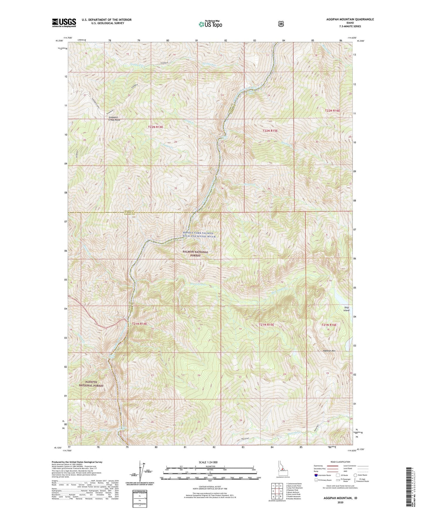
2024 topographic map quadrangle Aggipah Mountain in the state of Idaho. Scale: 1:24000. Based on the newly updated USGS 7.5' US Topo map series, this map is in the following counties: Lemhi, Idaho, Valley. The map contains contour data, water features, and other items you are used to seeing on USGS maps, but also has updated roads and other features. This is the next generation of topographic maps. Printed on high-quality waterproof paper with UV fade-resistant inks.
Quads adjacent to this one:
West: Papoose Peak
Northwest: Cottonwood Butte
North: Butts Creek Point
Northeast: Long Tom Mountain
East: Mount McGuire
Southeast: Hoodoo Meadows
South: Puddin Mountain
Southwest: Dave Lewis Peak
This map covers the same area as the classic USGS quad with code o45114b6.
Contains the following named places: Aggipah Mountain, Cliffside Rapids, Cradle Creek, Golden Creek, Lightning Strike Campground, North Fork Stoddard Creek, Nugget Creek, Ouzel Rapids, Papoose Creek, Papoose Creek Campground, Parrott Creek, Parrott Placer Campground, Porcupine Rapids, Redside Rapids, Reese Creek, Ship Island, Ship Island Creek, Ship Island Lake, Stoddard Creek, Stoddard Creek Lookout, Stoddard Creek Point, Tumble Creek, Twin Creek, Wall Creek, Waterfall Trail