MyTopo
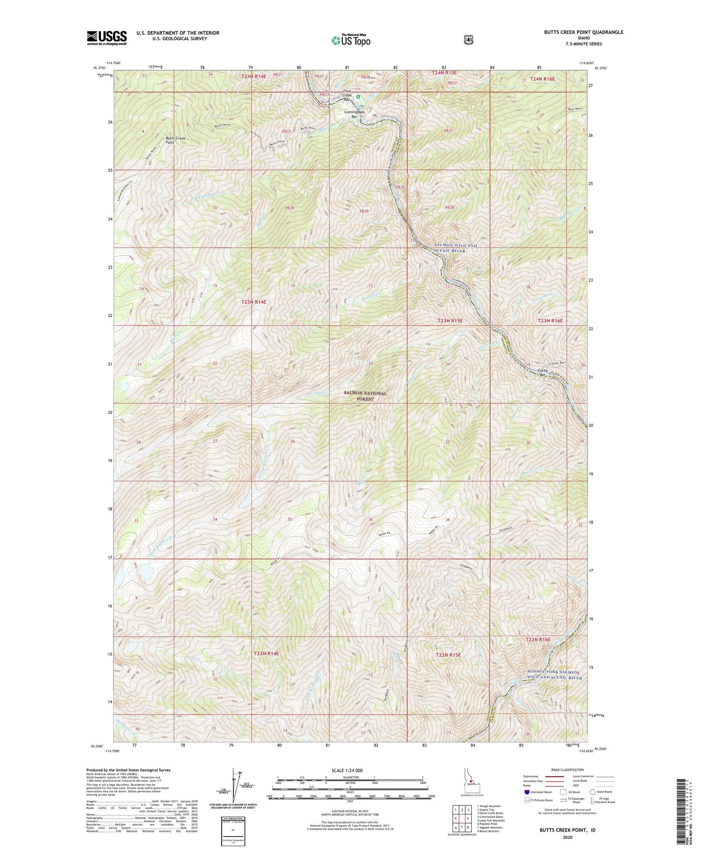
Butts Creek Point Idaho US Topo Map
Couldn't load pickup availability
Also explore the Butts Creek Point Forest Service Topo of this same quad for updated USFS data
2024 topographic map quadrangle Butts Creek Point in the state of Idaho. Scale: 1:24000. Based on the newly updated USGS 7.5' US Topo map series, this map is in the following counties: Idaho, Lemhi. The map contains contour data, water features, and other items you are used to seeing on USGS maps, but also has updated roads and other features. This is the next generation of topographic maps. Printed on high-quality waterproof paper with UV fade-resistant inks.
Quads adjacent to this one:
West: Cottonwood Butte
Northwest: Waugh Mountain
North: Square Top
Northeast: Horse Creek Butte
East: Long Tom Mountain
Southeast: Mount McGuire
South: Aggipah Mountain
Southwest: Papoose Peak
This map covers the same area as the classic USGS quad with code o45114c6.
Contains the following named places: Anita Creek, Bay Creek, Bear Basin Creek, Butts Creek, Butts Creek Point, Cache Bar, Cache Bar Campground, Corn Creek, Corn Creek Bar, Cramer Creek, Cunningham Bar, East Fork, Fountain Creek, Hancock Rapids, Kitchen Creek, Nolan Creek, Proctor Creek, Roaring Creek, South Fork Kitchen Creek, Stoddard Trail, West Fork Butts Creek, Wheat Creek