MyTopo
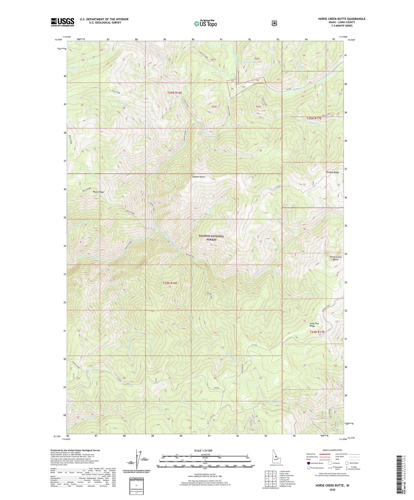
Horse Creek Butte Idaho US Topo Map
Couldn't load pickup availability
Also explore the Horse Creek Butte Forest Service Topo of this same quad for updated USFS data
2024 topographic map quadrangle Horse Creek Butte in the state of Idaho. Scale: 1:24000. Based on the newly updated USGS 7.5' US Topo map series, this map is in the following counties: Lemhi. The map contains contour data, water features, and other items you are used to seeing on USGS maps, but also has updated roads and other features. This is the next generation of topographic maps. Printed on high-quality waterproof paper with UV fade-resistant inks.
Quads adjacent to this one:
West: Square Top
Northwest: Wood Hump
North: Blue Joint
Northeast: Horse Creek Pass
East: Tincup Hill
Southeast: Bighorn Crags
South: Long Tom Mountain
Southwest: Butts Creek Point
This map covers the same area as the classic USGS quad with code o45114d5.
Contains the following named places: Big Indian Camp, Broomtail Creek, Cayuse Creek, Cayuse Point, Corn Lake, Filly Creek, Gattin Ranch, Horse Creek Butte, Little Horse Creek, Long Tom Ridge, Mustang Creek, Quicksand Bog, Reynolds Creek, Roan Creek, Saddle Creek, Stud Creek, Swamp Camp