MyTopo
Henry Idaho US Topo Map
Couldn't load pickup availability
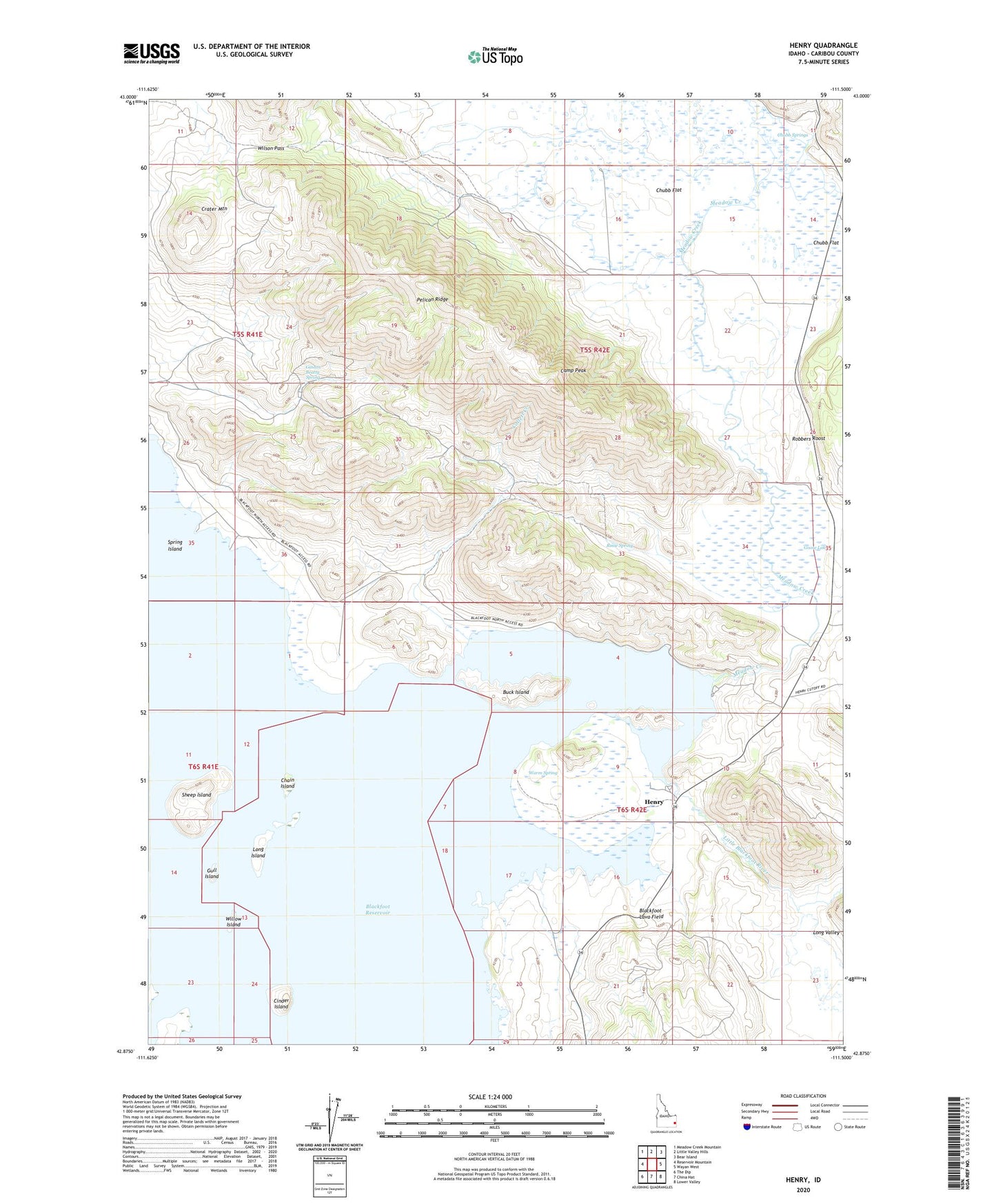
2024 topographic map quadrangle Henry in the state of Idaho. Scale: 1:24000. Based on the newly updated USGS 7.5' US Topo map series, this map is in the following counties: Caribou. The map contains contour data, water features, and other items you are used to seeing on USGS maps, but also has updated roads and other features. This is the next generation of topographic maps. Printed on high-quality waterproof paper with UV fade-resistant inks.
Quads adjacent to this one:
West: Reservoir Mountain
Northwest: Meadow Creek Mountain
North: Little Valley Hills
Northeast: Bear Island
East: Wayan West
Southeast: Lower Valley
South: China Hat
Southwest: The Dip
This map covers the same area as the classic USGS quad with code o42111h5.
Contains the following named places: Blackfoot Reservoir, Buck Island, Camp Peak, Chain Island, Chubb Flat, Chubb Springs, Cinder Island, Collett Creek, Crater Mountain, Gaston Beatty Spring, Goose Lake, Gull Island, Henry, Henry Stampede Park, Little Blackfoot River, Long Island, Long Valley, Meadow Creek, Pelican Ridge, Robbers Roost, Rosie Spring, Sheep Island, Spring Island, Warm Spring, Willow Island, Wilson Pass