MyTopo
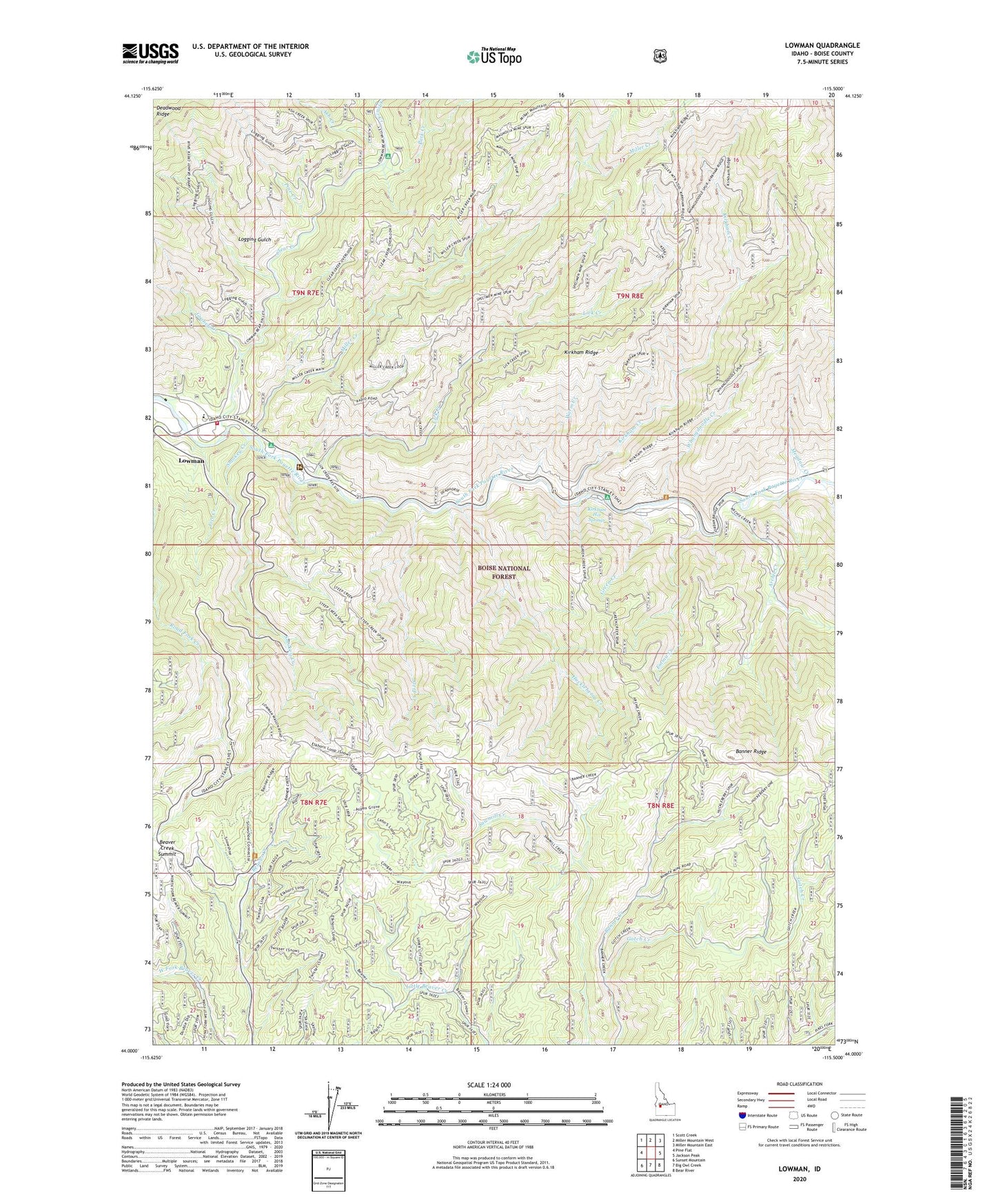
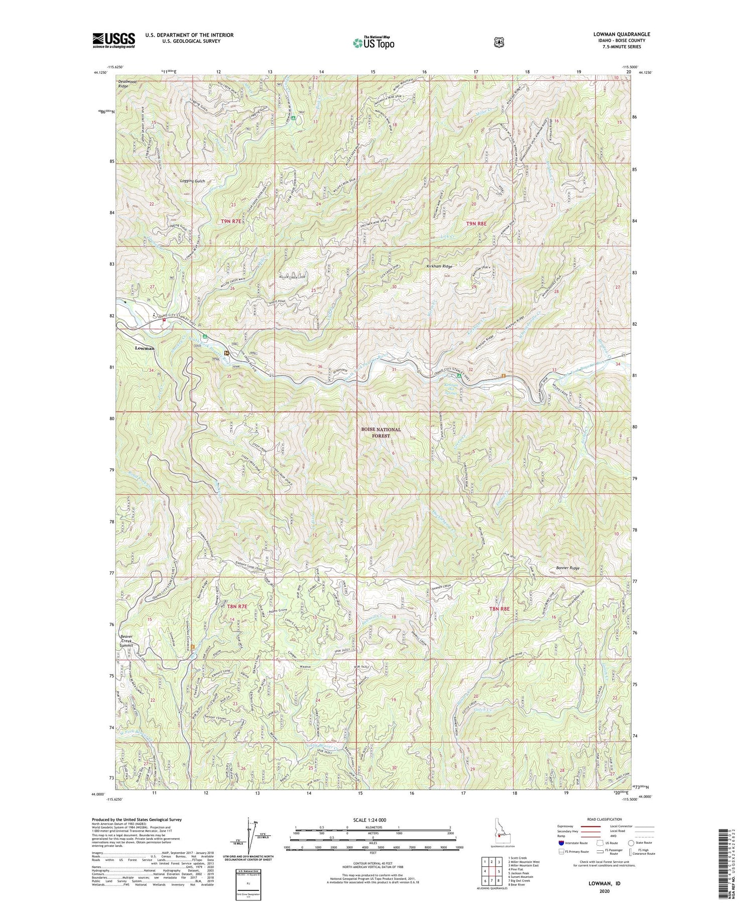
Lowman Idaho US Topo Map
Couldn't load pickup availability
Also explore the Lowman Forest Service Topo of this same quad for updated USFS data
2024 topographic map quadrangle Lowman in the state of Idaho. Scale: 1:24000. Based on the newly updated USGS 7.5' US Topo map series, this map is in the following counties: Boise. The map contains contour data, water features, and other items you are used to seeing on USGS maps, but also has updated roads and other features. This is the next generation of topographic maps. Printed on high-quality waterproof paper with UV fade-resistant inks.
Quads adjacent to this one:
West: Pine Flat
Northwest: Scott Creek
North: Miller Mountain West
Northeast: Miller Mountain East
East: Jackson Peak
Southeast: Bear River
South: Big Owl Creek
Southwest: Sunset Mountain
This map covers the same area as the classic USGS quad with code o44115a5.
Contains the following named places: Archie Creek, Ash Creek, Banner, Banner Mine, Banner Ridge, Banner Ridge Recreation Site, Beaver Creek Summit, Boise National Forest, Clear Creek, Emma Creek, Garden Valley Division, Gotch Creek, Graney Creek, Green Creek, Huckleberry Creek, Kirkham Creek, Kirkham Hot Springs, Kirkham Hot Springs Campground, Kirkham Ridge, Lice Creek, Lick Creek, Logging Gulch, Lower Ranger Station, Lowman, Lowman Census Designated Place, Lowman Elementary School, Lowman Ranger District, Lowman Volunteer Fire Department Station 3, Lowman Work Center, Meadow Creek, Miller Creek, Mountain View Campground, Park Creek, Park Creek Campground, Pine Creek, Smokey Creek, Specimen Mine, Steep Creek, Warm Creek, Whangdoodle Creek