MyTopo
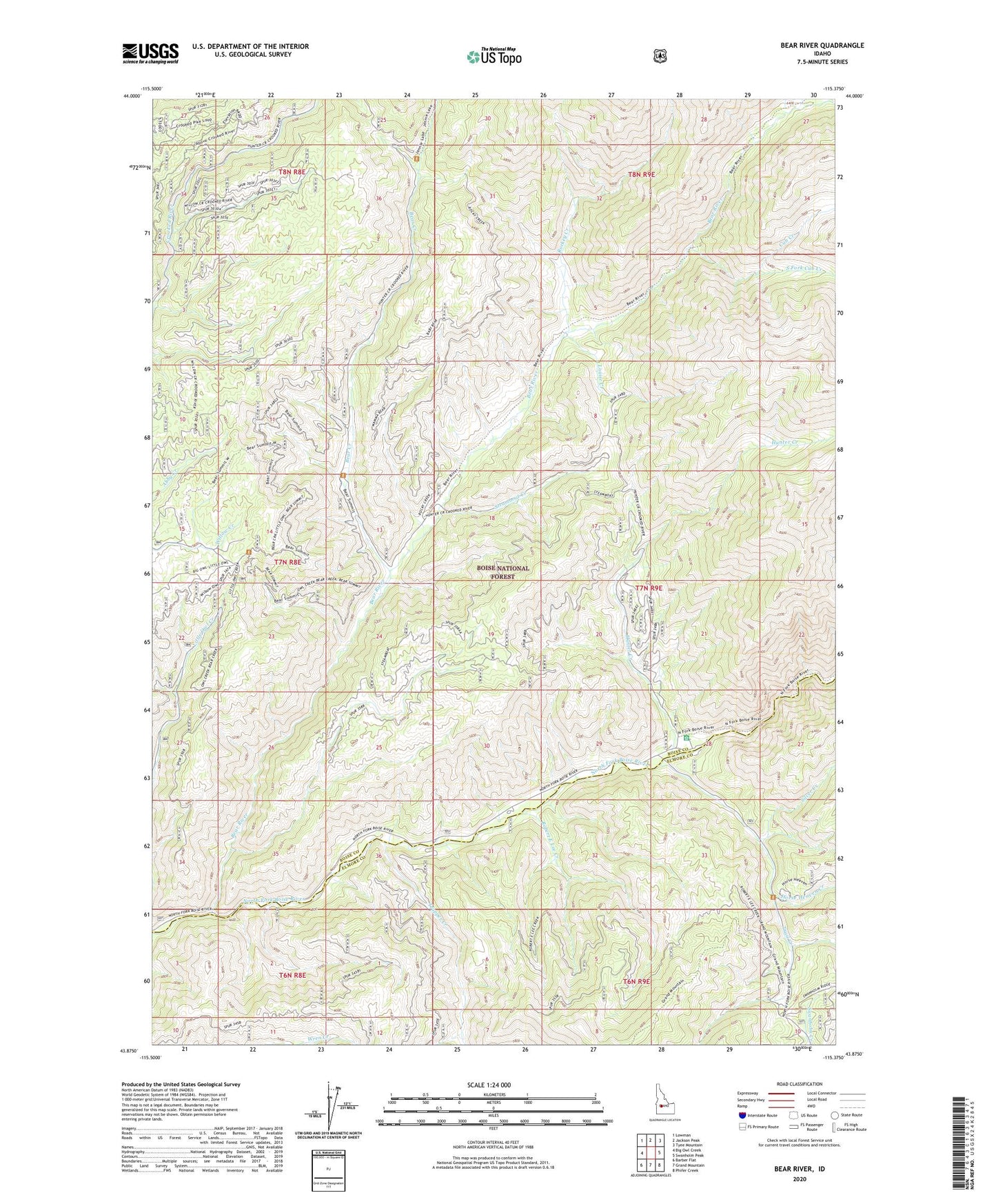
Bear River Idaho US Topo Map
Couldn't load pickup availability
Also explore the Bear River Forest Service Topo of this same quad for updated USFS data
2023 topographic map quadrangle Bear River in the state of Idaho. Scale: 1:24000. Based on the newly updated USGS 7.5' US Topo map series, this map is in the following counties: Boise, Elmore. The map contains contour data, water features, and other items you are used to seeing on USGS maps, but also has updated roads and other features. This is the next generation of topographic maps. Printed on high-quality waterproof paper with UV fade-resistant inks.
Quads adjacent to this one:
West: Big Owl Creek
Northwest: Lowman
North: Jackson Peak
Northeast: Tyee Mountain
East: Swanholm Peak
Southeast: Phifer Creek
South: Grand Mountain
Southwest: Barber Flat
This map covers the same area as the classic USGS quad with code o43115h4.
Contains the following named places: Bear Creek, Bear River, Cub Creek, Deer Park Campground, Deer Park Guard Station, Fourmile Campground, Horse Heaven Creek, Hunter Creek, Louise Creek, Robert E Lee Campground, Robert E Lee Creek, Rockey Creek, Silver Creek, South Fork Cub Creek, Steamboat Creek, Trail Creek, Trapper Creek