MyTopo
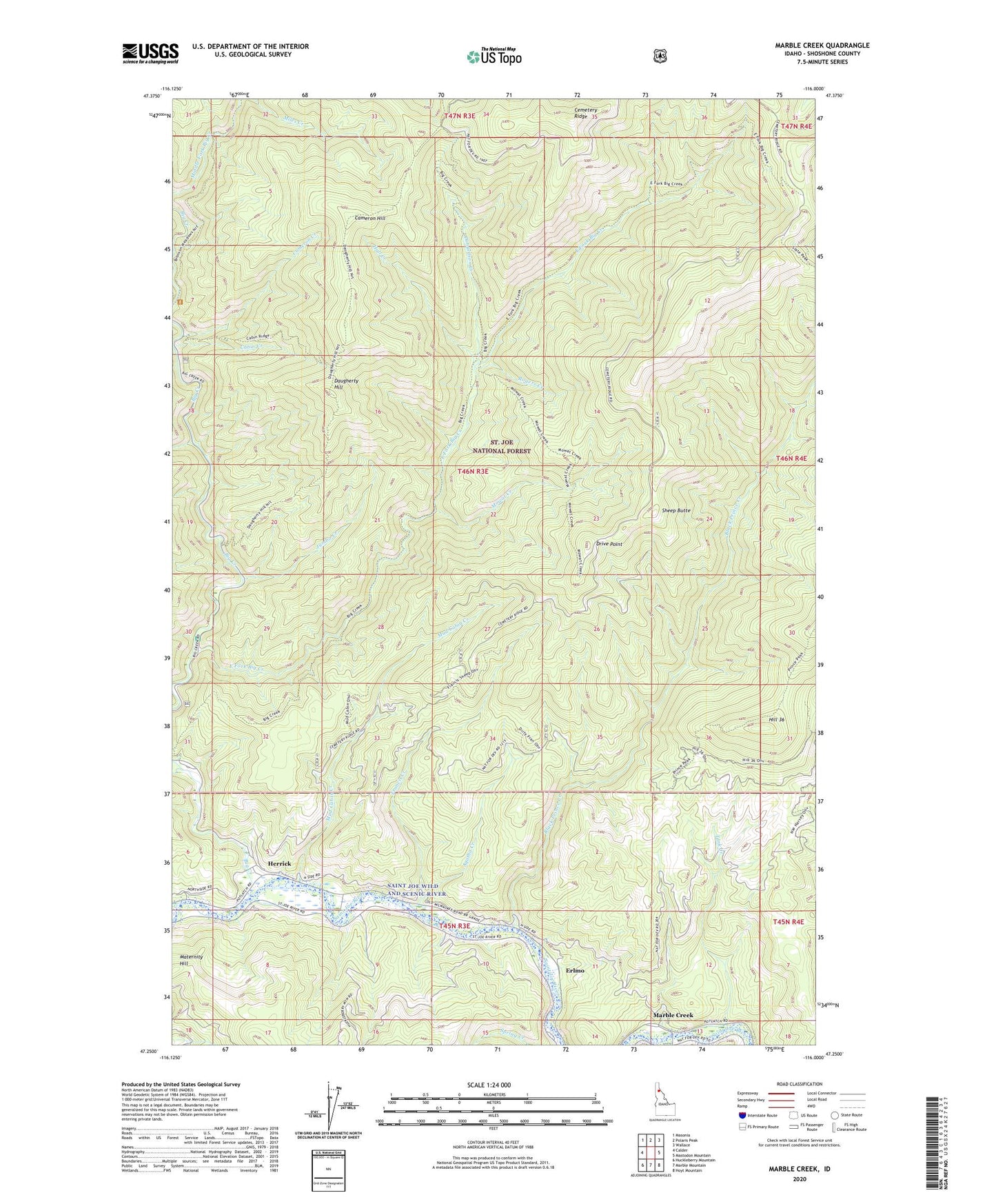
Marble Creek Idaho US Topo Map
Couldn't load pickup availability
Also explore the Marble Creek Forest Service Topo of this same quad for updated USFS data
2024 topographic map quadrangle Marble Creek in the state of Idaho. Scale: 1:24000. Based on the newly updated USGS 7.5' US Topo map series, this map is in the following counties: Shoshone. The map contains contour data, water features, and other items you are used to seeing on USGS maps, but also has updated roads and other features. This is the next generation of topographic maps. Printed on high-quality waterproof paper with UV fade-resistant inks.
Quads adjacent to this one:
West: Calder
Northwest: Masonia
North: Polaris Peak
Northeast: Wallace
East: Mastodon Mountain
Southeast: Hoyt Mountain
South: Marble Mountain
Southwest: Huckleberry Mountain
This map covers the same area as the classic USGS quad with code o47116c1.
Contains the following named places: Agatha Creek, Big Creek, Big Creek Cabin, Big Creek Campground, Black Prince Creek, Cabin Creek, Cameron Creek, Cameron Hill, CCC Campground, Cemetery Ridge, Daugherty Hill, Donaldson Creek, Drive Point, East Fork Big Creek, Erlmo, Flag Creek, Francis Creek, Hall Creek, Herrick, Hill 36, Huckleberry Flat Campground, Jumbo Creek, Marble Creek, Maternity Hill, Mowat Creek, Mud Cabin Creek, Rogers Creek, Sheep Butte, Tank Creek, ZIP Code: 83808