MyTopo
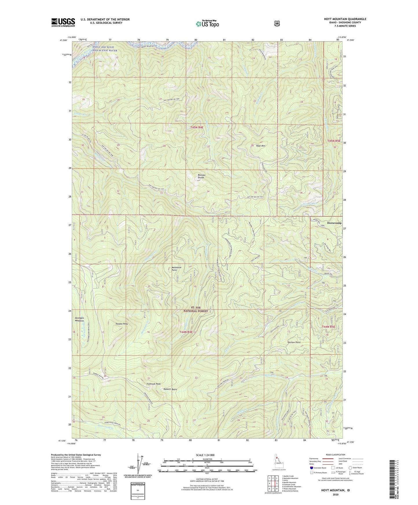
Hoyt Mountain Idaho US Topo Map
Couldn't load pickup availability
Also explore the Hoyt Mountain Forest Service Topo of this same quad for updated USFS data
2024 topographic map quadrangle Hoyt Mountain in the state of Idaho. Scale: 1:24000. Based on the newly updated USGS 7.5' US Topo map series, this map is in the following counties: Shoshone. The map contains contour data, water features, and other items you are used to seeing on USGS maps, but also has updated roads and other features. This is the next generation of topographic maps. Printed on high-quality waterproof paper with UV fade-resistant inks.
Quads adjacent to this one:
West: Marble Mountain
Northwest: Marble Creek
North: Mastodon Mountain
Northeast: Avery
East: Fishhook Creek
Southeast: Monumental Buttes
South: Widow Mountain
Southwest: Grandmother Mountain
This map covers the same area as the classic USGS quad with code o47115b8.
Contains the following named places: Birthday Creek, Boulder Divide, Burton Creek, Daveggio Meadows, Debbitt Basin, Fishhook Peak, Horsecamp, Hoyt Mountain, Malamute Creek, Malamute Point, Middle Creek, Outlaw Point, Red Raven Creek, Saint Joe National Forest, Twodot Peak