MyTopo
Huckleberry Mountain Idaho US Topo Map
Couldn't load pickup availability
Also explore the Huckleberry Mountain Forest Service Topo of this same quad for updated USFS data
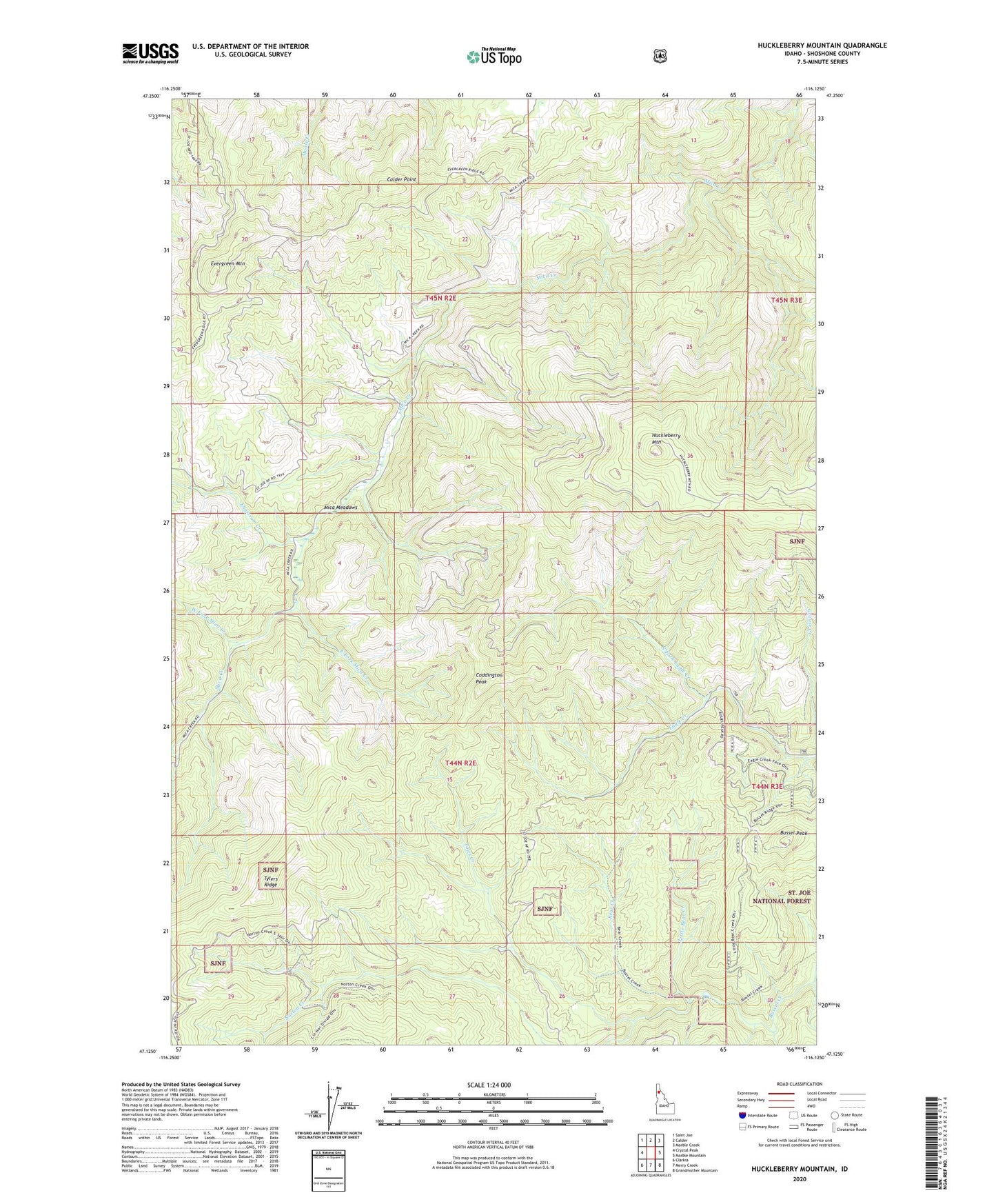
2024 topographic map quadrangle Huckleberry Mountain in the state of Idaho. Scale: 1:24000. Based on the newly updated USGS 7.5' US Topo map series, this map is in the following counties: Shoshone. The map contains contour data, water features, and other items you are used to seeing on USGS maps, but also has updated roads and other features. This is the next generation of topographic maps. Printed on high-quality waterproof paper with UV fade-resistant inks.
Quads adjacent to this one:
West: Crystal Peak
Northwest: Saint Joe
North: Calder
Northeast: Marble Creek
East: Marble Mountain
Southeast: Grandmother Mountain
South: Merry Creek
Southwest: Clarkia
This map covers the same area as the classic USGS quad with code o47116b2.
Contains the following named places: Bear Creek, Bussel Peak, Calder Point, Coddington Peak, East Fork Mica Creek, Engstrom Creek, Evergreen Mountain, Huckleberry Mountain, Little Bear Creek, Mica Meadows, North Fork Eagle Creek, Toles Creek, Tylers Ridge, West Fork Mica Creek