MyTopo
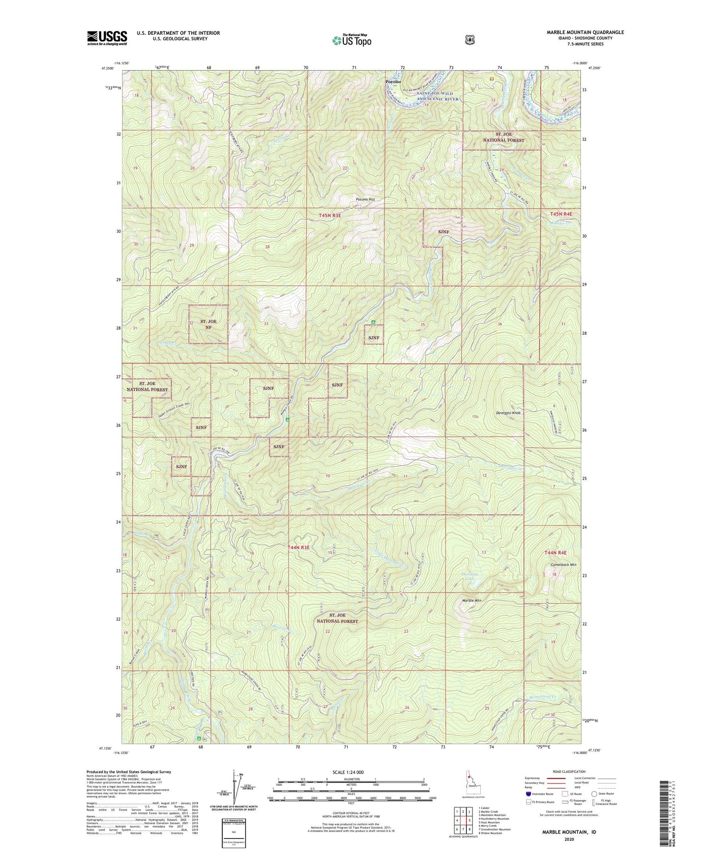
Marble Mountain Idaho US Topo Map
Couldn't load pickup availability
Also explore the Marble Mountain Forest Service Topo of this same quad for updated USFS data
2024 topographic map quadrangle Marble Mountain in the state of Idaho. Scale: 1:24000. Based on the newly updated USGS 7.5' US Topo map series, this map is in the following counties: Shoshone. The map contains contour data, water features, and other items you are used to seeing on USGS maps, but also has updated roads and other features. This is the next generation of topographic maps. Printed on high-quality waterproof paper with UV fade-resistant inks.
Quads adjacent to this one:
West: Huckleberry Mountain
Northwest: Calder
North: Marble Creek
Northeast: Mastodon Mountain
East: Hoyt Mountain
Southeast: Widow Mountain
South: Grandmother Mountain
Southwest: Merry Creek
This map covers the same area as the classic USGS quad with code o47116b1.
Contains the following named places: Boulder Creek, Bussel Creek, Camelback Mountain, Camp Three, Canyon Creek, Cranberry Creek, Daveggio Creek, Daveggio Knob, Donkey Creek, Donkey Recreation Site, Eagle Creek, Grouse Creek, Little Daveggio Creek, Marble Creek Campground, Marble Creek Splash Dam, Marble Mountain, Pocono, Pocono Creek, Pocono Hill, Shearer Creek, Spring Creek, Theriault Lake