
MyTopo
Givens Hot Springs Idaho US Topo Map
Couldn't load pickup availability
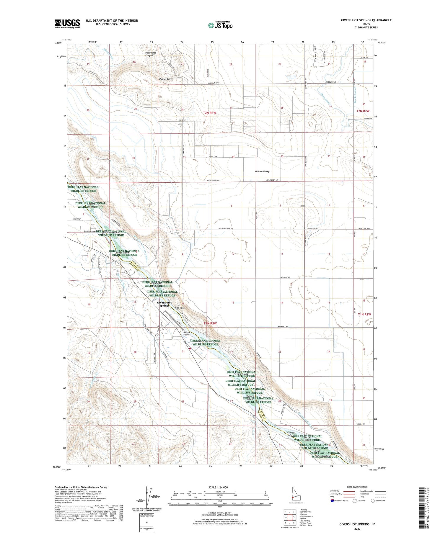
2023 topographic map quadrangle Givens Hot Springs in the state of Idaho. Scale: 1:24000. Based on the newly updated USGS 7.5' US Topo map series, this map is in the following counties: Canyon, Owyhee. The map contains contour data, water features, and other items you are used to seeing on USGS maps, but also has updated roads and other features. This is the next generation of topographic maps. Printed on high-quality waterproof paper with UV fade-resistant inks.
Quads adjacent to this one:
West: Opalene Gulch
Northwest: Marsing
North: Lake Lowell
Northeast: Nampa
East: Melba
Southeast: Walters Butte
South: Wilson Peak
Southwest: Soldier Cap
This map covers the same area as the classic USGS quad with code o43116d6.
Contains the following named places: Bernard Ferry, Blackburn Island, Brooks Lateral, Current Island, Deadhorse Canyon, Dredge Island, Fischer Island, Foglers Island, Givens Hot Springs, Goldeneye Island, Hardtrigger Creek, Hermit Island, Hidden Valley, Map Rock, Nicholson Ditch, Opalene Ditch, Pickles Butte, Raccoon Island, Richards Island, Rippee Island, Sunrise Skypark, Ware Island, Warm Springs Ferry


