MyTopo
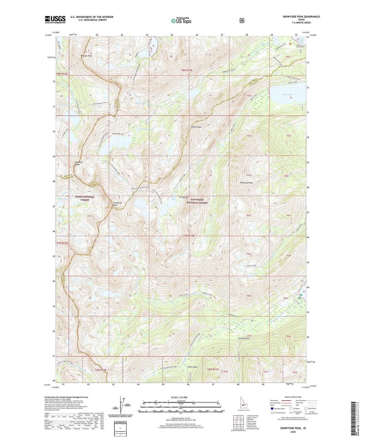
Snowyside Peak Idaho US Topo Map
Couldn't load pickup availability
Also explore the Snowyside Peak Forest Service Topo of this same quad for updated USFS data
2024 topographic map quadrangle Snowyside Peak in the state of Idaho. Scale: 1:24000. Based on the newly updated USGS 7.5' US Topo map series, this map is in the following counties: Blaine, Custer, Elmore, Boise. The map contains contour data, water features, and other items you are used to seeing on USGS maps, but also has updated roads and other features. This is the next generation of topographic maps. Printed on high-quality waterproof paper with UV fade-resistant inks.
Quads adjacent to this one:
West: Mount Everly
Northwest: Warbonnet Peak
North: Mount Cramer
Northeast: Obsidian
East: Alturas Lake
Southeast: Frenchman Creek
South: Marshall Peak
Southwest: Atlanta East
This map covers the same area as the classic USGS quad with code o43114h8.
Contains the following named places: Alice Lake, Alpine Creek, Alturas Inlet Campground, Bowknot Lake, Edith Lake, Edna Lake, El Capitan, Eureka Gulch, Farley Lake, Heart Lake, Imogene Lake, Jakes Gulch, McDonald Lake, McDonald Peak, Parks Peak, Payette Peak, Pettit Lake, Snowyside Peak, Toxaway Lake, Twin Lakes, Vernon Lake, Virginia Lake