MyTopo
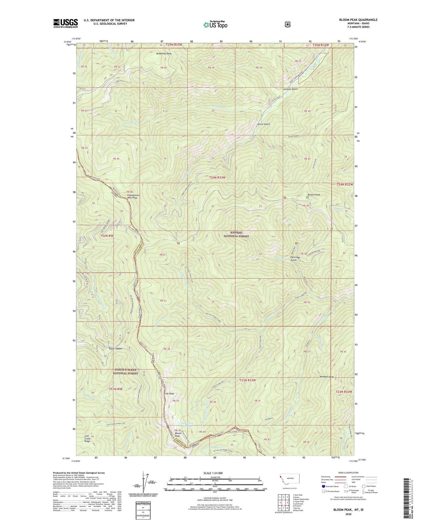
Bloom Peak Montana US Topo Map
Couldn't load pickup availability
Also explore the Bloom Peak Forest Service Topo of this same quad for updated USFS data
2024 topographic map quadrangle Bloom Peak in the states of Montana, Idaho. Scale: 1:24000. Based on the newly updated USGS 7.5' US Topo map series, this map is in the following counties: Sanders, Shoshone. The map contains contour data, water features, and other items you are used to seeing on USGS maps, but also has updated roads and other features. This is the next generation of topographic maps. Printed on high-quality waterproof paper with UV fade-resistant inks.
Quads adjacent to this one:
West: Taylor Peak
Northwest: Gem Peak
North: Noxon
Northeast: Noxon Rapids Dam
East: Larchwood
Southeast: Black Peak
South: Murray
Southwest: Prichard
This map covers the same area as the classic USGS quad with code o47115g7.
Contains the following named places: Attlebury Creek, Bloom Peak, Devil Run, Eightyseven Mile Peak, Jackson Gulch, Lost Creek Ridge, Lost Peak, McNeeley Creek, McNeeley Peak, Minton Peak, Minton Peak Lookout Station, Ninetythree Mile Lake, Partridge Gulch, Robin Run, Sorrel Gulch, South Branch West Fork Trout Creek, Taylor Saddle, Windfall Creek, Windfall Peak