MyTopo
New Plymouth Idaho US Topo Map
Couldn't load pickup availability
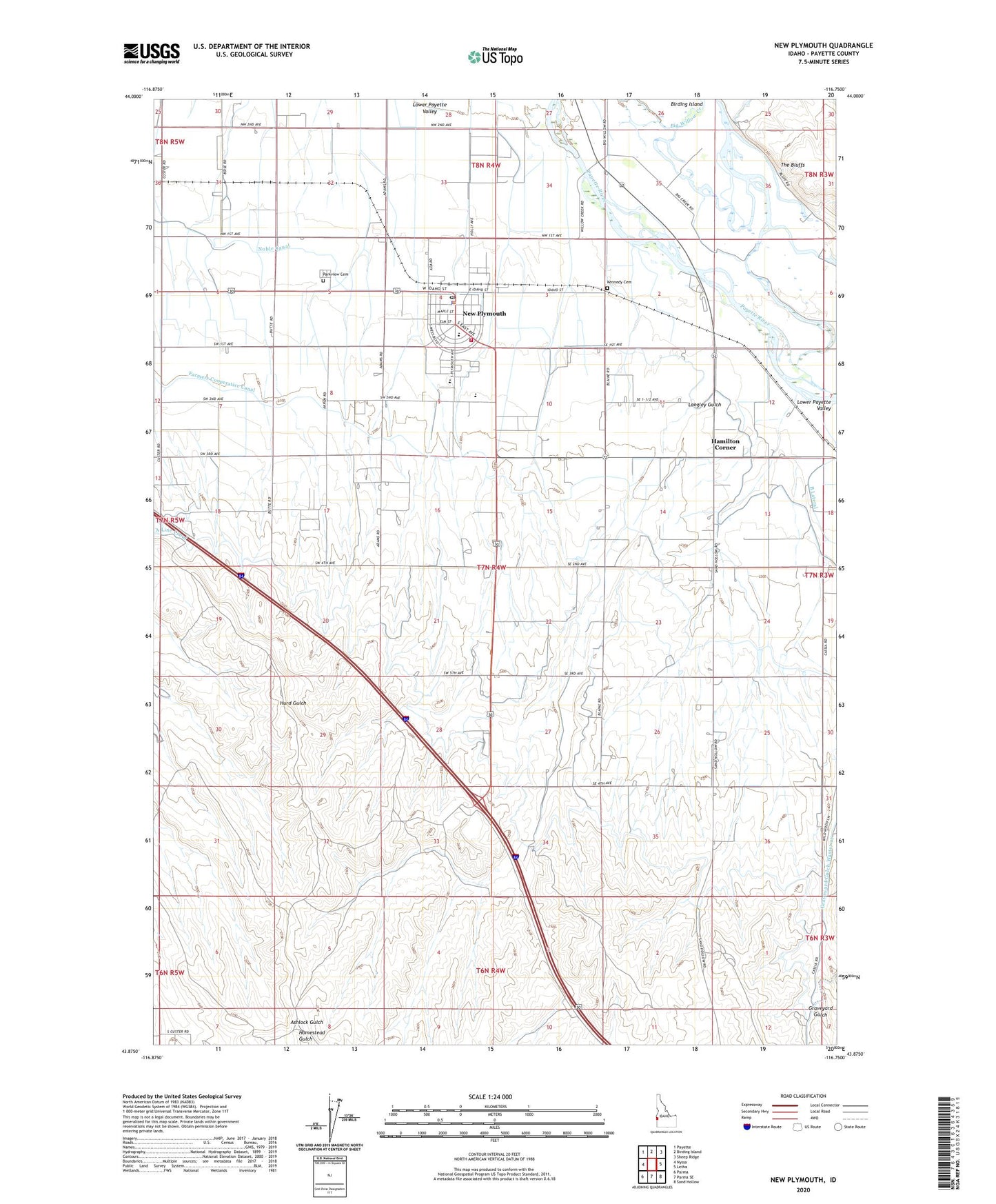
2023 topographic map quadrangle New Plymouth in the state of Idaho. Scale: 1:24000. Based on the newly updated USGS 7.5' US Topo map series, this map is in the following counties: Payette. The map contains contour data, water features, and other items you are used to seeing on USGS maps, but also has updated roads and other features. This is the next generation of topographic maps. Printed on high-quality waterproof paper with UV fade-resistant inks.
Quads adjacent to this one:
West: Nyssa
Northwest: Payette
North: Birding Island
Northeast: Sheep Ridge
East: Letha
Southeast: Sand Hollow
South: Parma SE
Southwest: Parma
This map covers the same area as the classic USGS quad with code o43116h7.
Contains the following named places: Blacks Bridge Access Area, Bluff Station Ferry, City of New Plymouth, Farmers Cooperative Canal, Hamilton Corner, Kennedy Cemetery, Langley Gulch, Lower Payette Valley, New Plymouth, New Plymouth Division, New Plymouth Elementary School, New Plymouth Fire Department, New Plymouth High School, New Plymouth Middle School, New Plymouth Police Department, New Plymouth Post Office, Noble Canal, Parkview Cemetery, Payette River Wildlife Management Area, The Bluffs, ZIP Code: 83655