MyTopo
Parma Idaho US Topo Map
Couldn't load pickup availability
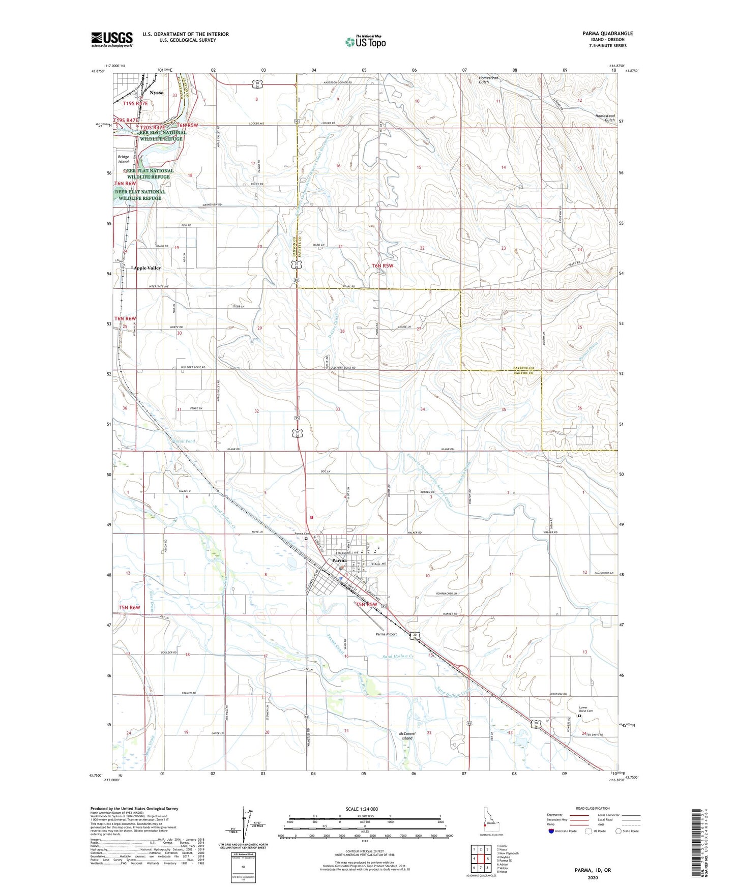
2023 topographic map quadrangle Parma in the states of Idaho, Oregon. Scale: 1:24000. Based on the newly updated USGS 7.5' US Topo map series, this map is in the following counties: Canyon, Payette, Malheur. The map contains contour data, water features, and other items you are used to seeing on USGS maps, but also has updated roads and other features. This is the next generation of topographic maps. Printed on high-quality waterproof paper with UV fade-resistant inks.
Quads adjacent to this one:
West: Owyhee
Northwest: Cairo
North: Nyssa
Northeast: New Plymouth
East: Parma SE
Southeast: Notus
South: Wilder
Southwest: Adrian
Contains the following named places: Alkali Drain, Apple Valley, Apple Valley School, City of Parma, D-Line Canal, Farmers Cooperative Sebree Canal Extension, Lower Boise Cemetery, Maxine Johnson Elementary, McConnel Island, Parma, Parma Airport, Parma Canal, Parma Cemetery, Parma Division, Parma Drain, Parma High School, Parma Middle School, Parma Police Department, Parma Post Office, Parma Rural Fire District, Pintail Pond, Redhead Pond, Ross East End Drain, South Park, Takatori Access Area, Univ of Idaho Agriculture Experiment Station, Wood Duck Pond, ZIP Code: 83660