MyTopo
Webb Creek Idaho US Topo Map
Couldn't load pickup availability
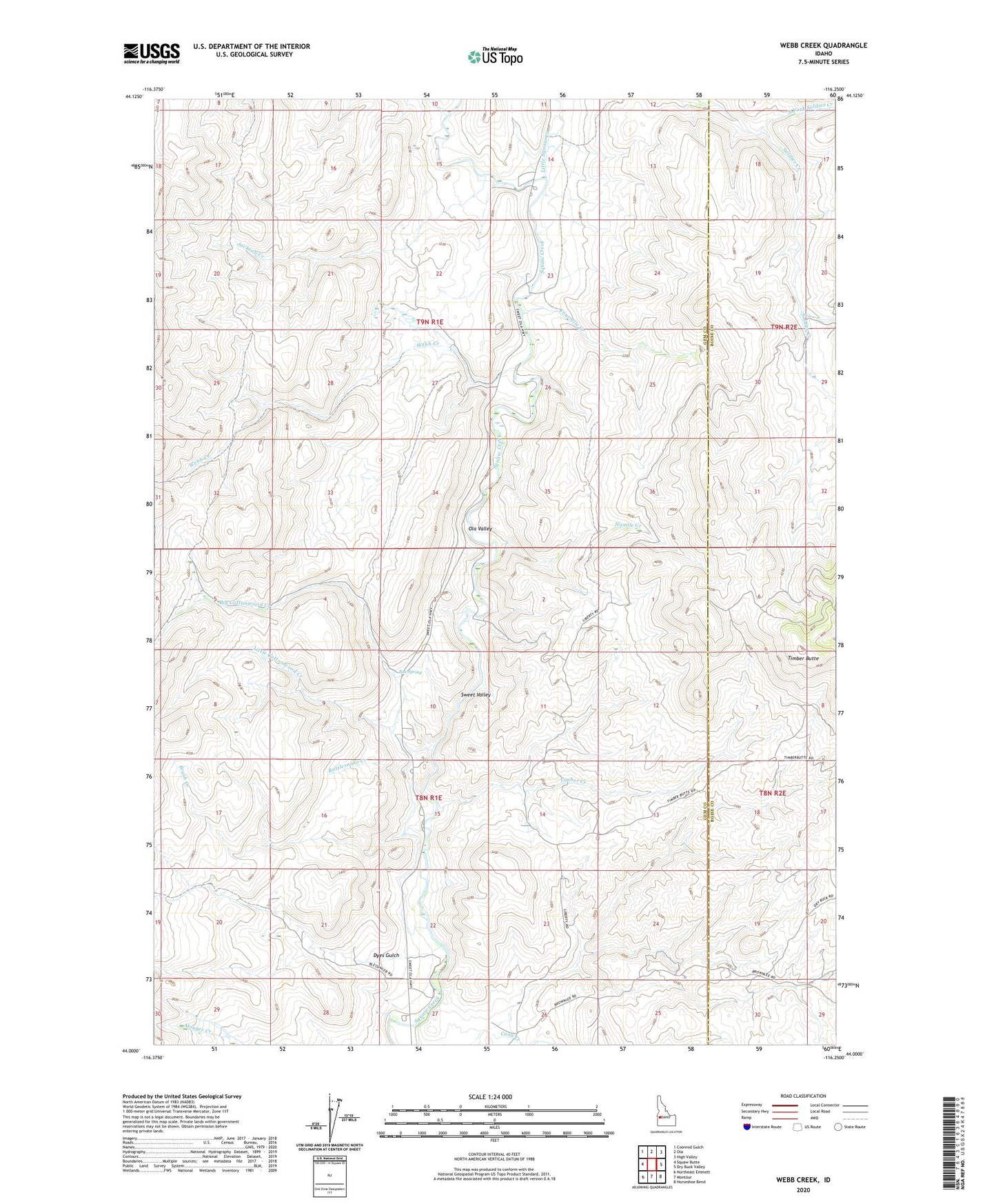
2024 topographic map quadrangle Webb Creek in the state of Idaho. Scale: 1:24000. Based on the newly updated USGS 7.5' US Topo map series, this map is in the following counties: Gem, Boise. The map contains contour data, water features, and other items you are used to seeing on USGS maps, but also has updated roads and other features. This is the next generation of topographic maps. Printed on high-quality waterproof paper with UV fade-resistant inks.
Quads adjacent to this one:
West: Squaw Butte
Northwest: Coonrod Gulch
North: Ola
Northeast: High Valley
East: Dry Buck Valley
Southeast: Horseshoe Bend
South: Montour
Southwest: Northeast Emmett
This map covers the same area as the classic USGS quad with code o44116a3.
Contains the following named places: Big Cottonwood Creek, Box Spring, Brush Creek, Dyes Gulch, Fourmile Creek, Jackson Creek, Liberty Mine, Little Cottonwood Creek, Little Squaw Creek, Middle Fork Soldier Creek, North Fork Soldier Creek, Ola Valley, Rattlesnake Creek, Sixmile Creek, Sweet Division, Timber Creek, Webb Creek, ZIP Code: 83670