MyTopo
Owinza Butte Idaho US Topo Map
Couldn't load pickup availability
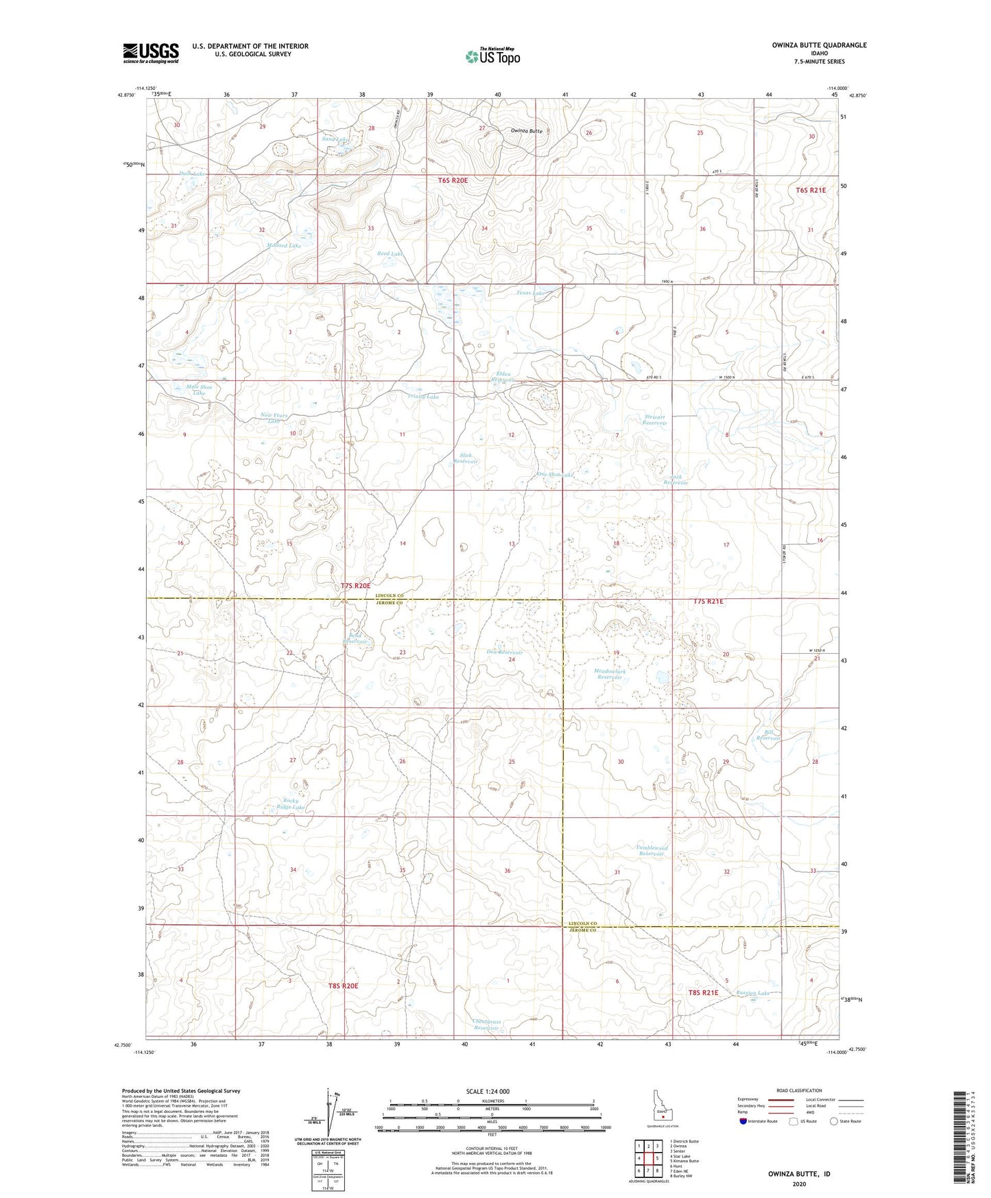
2024 topographic map quadrangle Owinza Butte in the state of Idaho. Scale: 1:24000. Based on the newly updated USGS 7.5' US Topo map series, this map is in the following counties: Lincoln, Jerome. The map contains contour data, water features, and other items you are used to seeing on USGS maps, but also has updated roads and other features. This is the next generation of topographic maps. Printed on high-quality waterproof paper with UV fade-resistant inks.
Quads adjacent to this one:
West: Star Lake
Northwest: Dietrich Butte
North: Owinza
Northeast: Senter
East: Kimama Butte
Southeast: Burley NW
South: Eden NE
Southwest: Hunt
This map covers the same area as the classic USGS quad with code o42114g1.
Contains the following named places: Bend Reservoir, Bill Reservoir, Cheatgrass Reservoir, Don Reservoir, Duck Lake, Elden Reservoir, Jack Reservoir, Mallard Lake, Meadowlark Reservoir, Mule Shoe Lake, New Years Lake, One Shot Lake, Owinza Butte, Owinza Butte Lake, Owinza Well, Reed Lake, Rocky Ridge Lake, Russian Lake, Sand Lake, Slick Reservoir, Stage Barn Well, Stewart Reservoir, Texas Lake, Trinity Lake, Tumbleweed Reservoir, Wilson Ridge Well