MyTopo
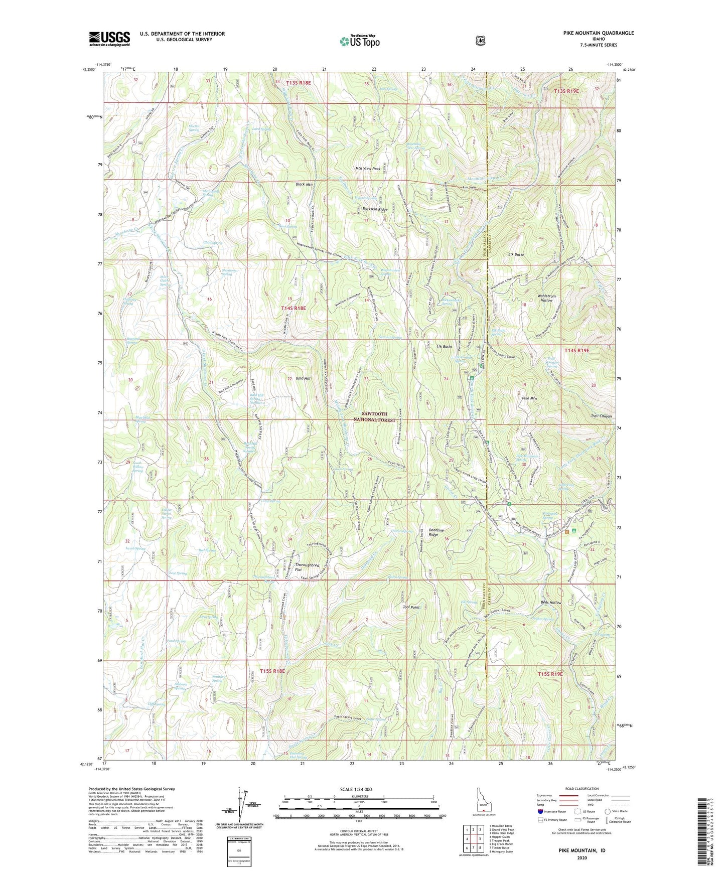
Pike Mountain Idaho US Topo Map
Couldn't load pickup availability
Also explore the Pike Mountain Forest Service Topo of this same quad for updated USFS data
2023 topographic map quadrangle Pike Mountain in the state of Idaho. Scale: 1:24000. Based on the newly updated USGS 7.5' US Topo map series, this map is in the following counties: Twin Falls, Cassia. The map contains contour data, water features, and other items you are used to seeing on USGS maps, but also has updated roads and other features. This is the next generation of topographic maps. Printed on high-quality waterproof paper with UV fade-resistant inks.
Quads adjacent to this one:
West: Hopper Gulch
Northwest: McMullen Basin
North: Grand View Peak
Northeast: Rams Horn Ridge
East: Trapper Peak
Southeast: Mahogany Butte
South: Timber Butte
Southwest: Big Creek Ranch
This map covers the same area as the classic USGS quad with code o42114b3.
Contains the following named places: Ashbury Spring, Bald Hill, Bald Hill Spring Number 1, Bald Hill Spring Number 2, Bear Hollow, Black Mountain, Blind Creek, Blue Mud Spring, Buckskin Ridge, Bud Spring, Buzzard Spring, Camp Spring, Chad Spring, Cliff Spring, Deadline Corral, Deer Spring, Diamond Creek, Eagle Spring, Eagle Spring Creek, Electric Spring, Electric Spring Creek, Elk Basin, Elk Butte, Elk Butte Spring, Elk Corral Spring, Elk Spring, F S Spring, F S Spring Creek, Fawn Spring, Frahm Spring, Halfway Spring, Hinton Spring, Jack Creek, Joes Spring, Kirkman Campground, Kum Ba Yah Camp, Lamb Spring, Lava Spring, Little Fork Spring, Lost Spring, Lower Penstemon Campground, Magic Mountain Ski Area, McConnell Spring, Middle Fork Shoshone Creek, Middle Fork Third Fork Rock Creek, Mountain View Creek, Mountain View Peak, Mountain View Spring, Narrows Creek, North Fork Narrows Creek, North Fork Shoshone Creek, Orin Spring, Pedro Spring, Pettit Campground, Pike Mountain, Pike Mountain Spring, Pond Spring, Porcupine Spring, Porcupine Spring Picnic Area, Rickenbacker Spring, Rock Creek Guard Station, Ross Falls, Sanitary Spring, Shoshone Cabin, Shoshone Forest Service Station, Shoshone Spring, South Fork Narrows Creek, South Fork Shoshone Creek, South Willow Spring, Stove Gulch Spring, Summit Spring, Tawakani Camp, Thoroughbred Flat, Thoroughbred Spring, Tool Point, Toolbox Creek, Trail Canyon, Trail Canyon Spring, Upper Penstemon Campground, Wagon Spring, Wagonwheel Spring, Yellow Jacket Spring