MyTopo
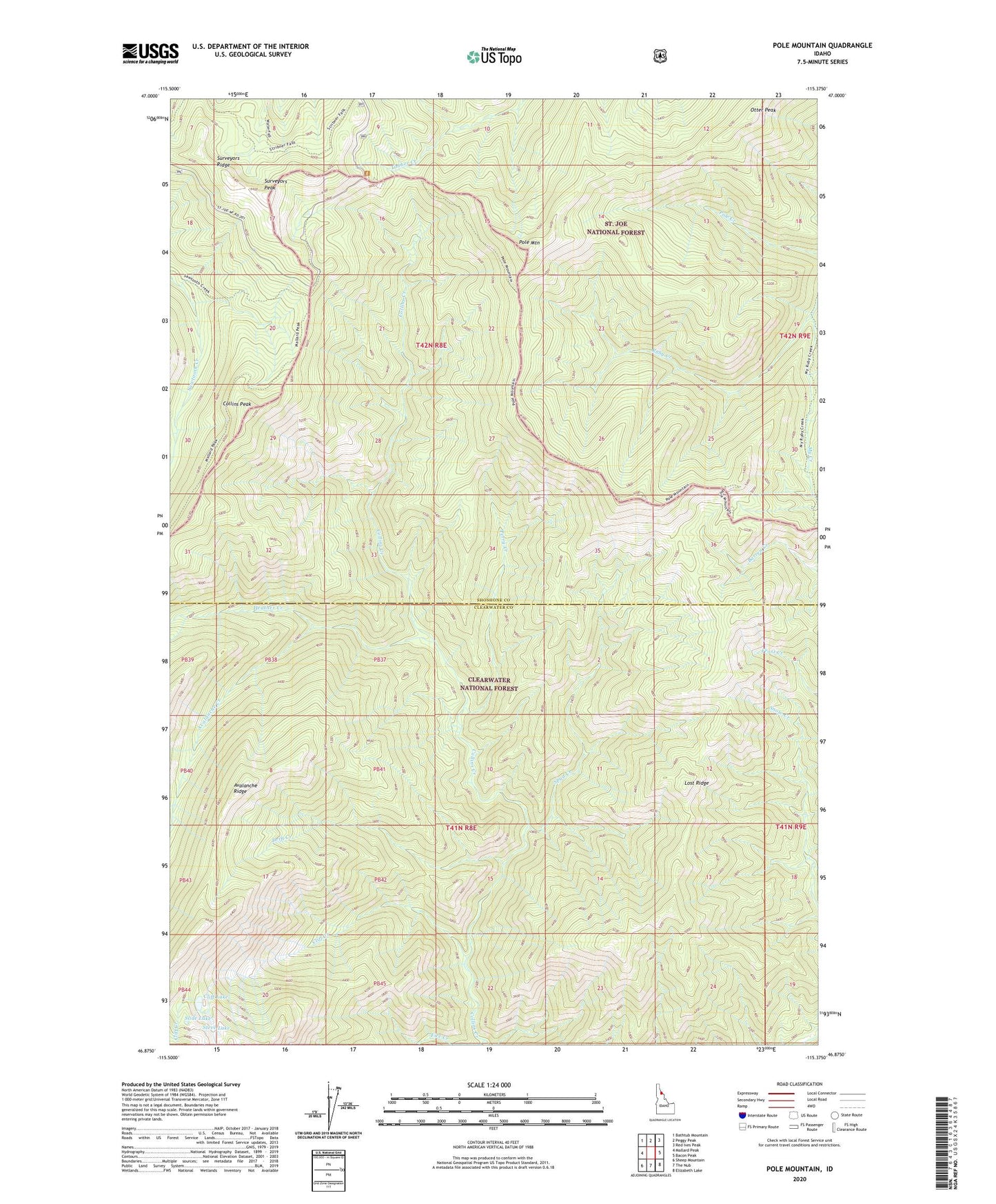
Pole Mountain Idaho US Topo Map
Couldn't load pickup availability
Also explore the Pole Mountain Forest Service Topo of this same quad for updated USFS data
2024 topographic map quadrangle Pole Mountain in the state of Idaho. Scale: 1:24000. Based on the newly updated USGS 7.5' US Topo map series, this map is in the following counties: Shoshone, Clearwater. The map contains contour data, water features, and other items you are used to seeing on USGS maps, but also has updated roads and other features. This is the next generation of topographic maps. Printed on high-quality waterproof paper with UV fade-resistant inks.
Quads adjacent to this one:
West: Mallard Peak
Northwest: Bathtub Mountain
North: Peggy Peak
Northeast: Red Ives Peak
East: Bacon Peak
Southeast: Elizabeth Lake
South: The Nub
Southwest: Sheep Mountain
This map covers the same area as the classic USGS quad with code o46115h4.
Contains the following named places: Avalanche Creek, Avalanche Ridge, Cliff Creek, Cliff Lake, Collins Peak, Drift Creek, Fire Creek, Heather Creek, Lost Ridge, My Creek, Otter Peak, Perry Creek, Pole Mountain, Slide Lake, Spud Creek, Steve Lake, Surveyors Peak, Surveyors Ridge