MyTopo
Moscow Mountain Idaho US Topo Map
Couldn't load pickup availability
Also explore the Moscow Mountain Forest Service Topo of this same quad for updated USFS data
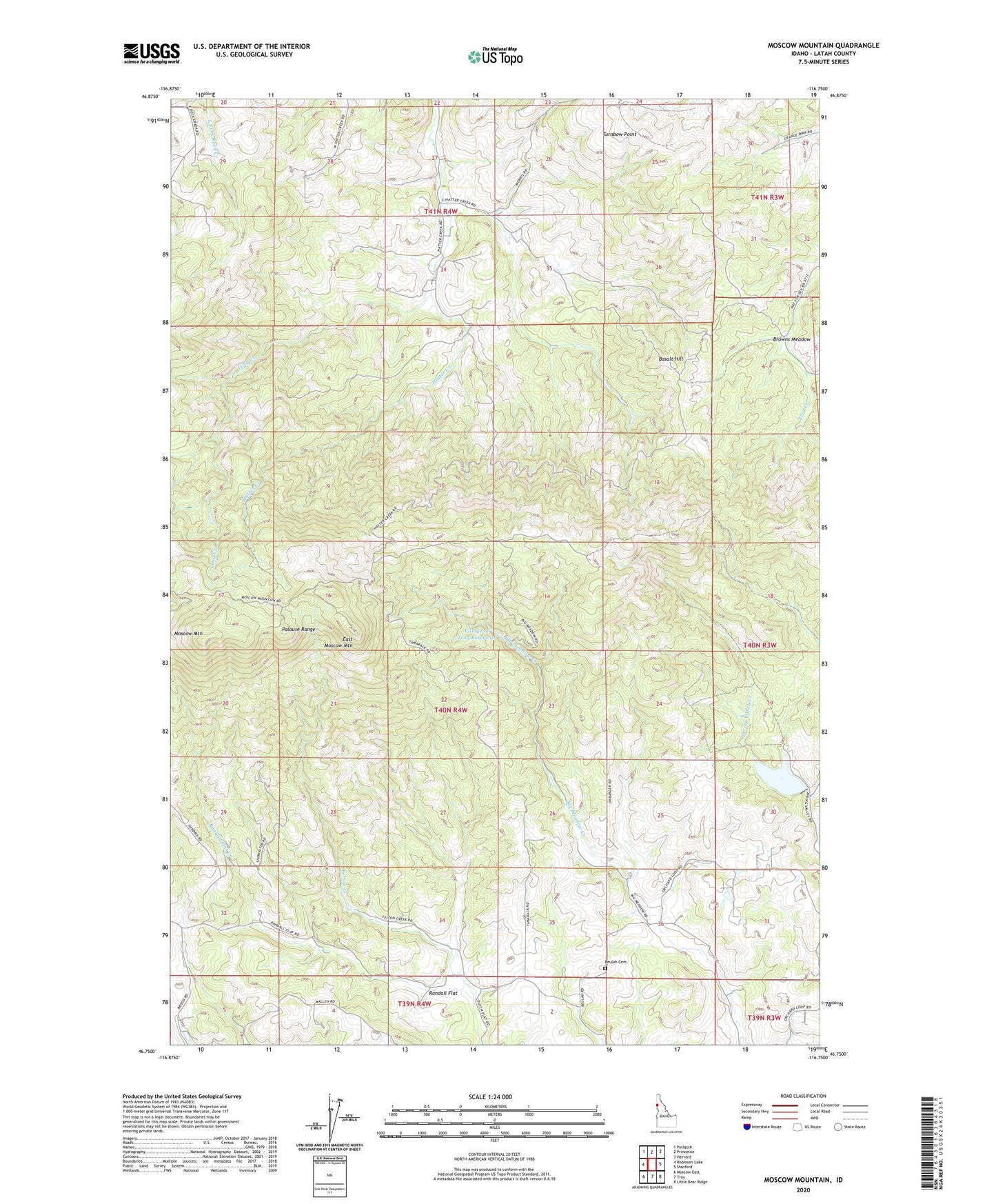
2024 topographic map quadrangle Moscow Mountain in the state of Idaho. Scale: 1:24000. Based on the newly updated USGS 7.5' US Topo map series, this map is in the following counties: Latah. The map contains contour data, water features, and other items you are used to seeing on USGS maps, but also has updated roads and other features. This is the next generation of topographic maps. Printed on high-quality waterproof paper with UV fade-resistant inks.
Quads adjacent to this one:
West: Robinson Lake
Northwest: Potlatch
North: Princeton
Northeast: Harvard
East: Stanford
Southeast: Little Bear Ridge
South: Troy
Southwest: Moscow East
This map covers the same area as the classic USGS quad with code o46116g7.
Contains the following named places: Basalt Hill, Bergs Creek, Beulah Cemetery, Browns Meadow, East Moscow Lookout, East Moscow Mountain, Felton Creek, Lamarack Ski Area, Long Creek, Moscow Mountain, Moscow Mountain Picnic Area, Palouse Range, Randall Flat, Randall Flat Creek, Spring Valley Dam, Spring Valley Recreation Site, Spring Valley Reservoir, Spring Valley Reservoir Public Fishing Area, Troy Dam, Turnbow Point, University of Idaho Experimental Forest, Village of Troy Reservoir