MyTopo
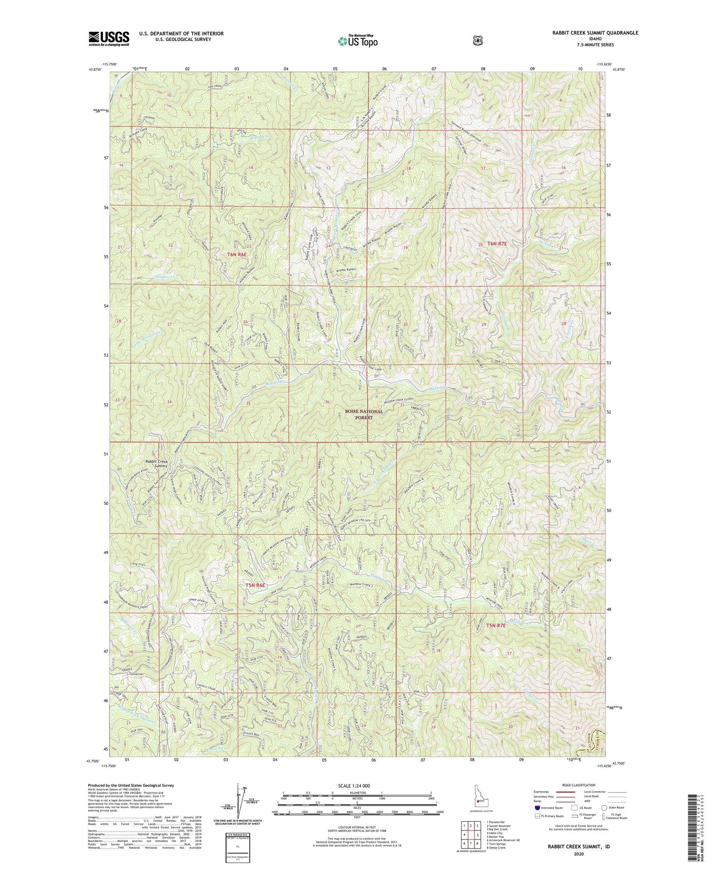
Rabbit Creek Summit Idaho US Topo Map
Couldn't load pickup availability
Also explore the Rabbit Creek Summit Forest Service Topo of this same quad for updated USFS data
2023 topographic map quadrangle Rabbit Creek Summit in the state of Idaho. Scale: 1:24000. Based on the newly updated USGS 7.5' US Topo map series, this map is in the following counties: Boise, Elmore. The map contains contour data, water features, and other items you are used to seeing on USGS maps, but also has updated roads and other features. This is the next generation of topographic maps. Printed on high-quality waterproof paper with UV fade-resistant inks.
Quads adjacent to this one:
West: Idaho City
Northwest: Pioneerville
North: Sunset Mountain
Northeast: Big Owl Creek
East: Barber Flat
Southeast: Sheep Creek
South: Twin Springs
Southwest: Arrowrock Reservoir NE
This map covers the same area as the classic USGS quad with code o43115g6.
Contains the following named places: Flicker Creek, Fourth Creek, German Creek, North Fork French Creek, North Fork Rabbit Creek, Rabbit Creek Summit, South Fork Rabbit Creek, Third Creek, ZIP Code: 83631