MyTopo
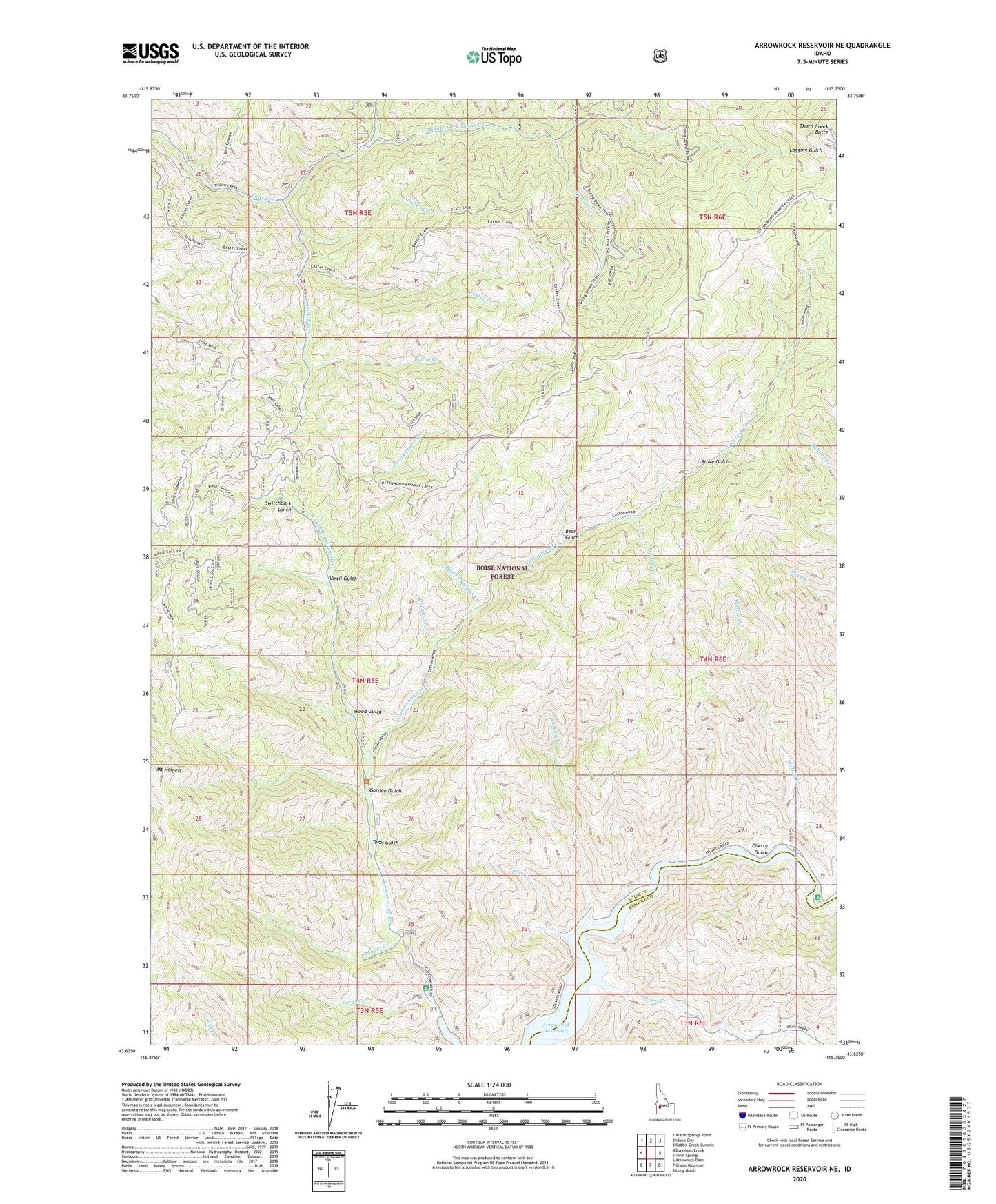
Arrowrock Reservoir NE Idaho US Topo Map
Couldn't load pickup availability
Also explore the Arrowrock Reservoir NE Forest Service Topo of this same quad for updated USFS data
2024 topographic map quadrangle Arrowrock Reservoir NE in the state of Idaho. Scale: 1:24000. Based on the newly updated USGS 7.5' US Topo map series, this map is in the following counties: Boise, Elmore. The map contains contour data, water features, and other items you are used to seeing on USGS maps, but also has updated roads and other features. This is the next generation of topographic maps. Printed on high-quality waterproof paper with UV fade-resistant inks.
Quads adjacent to this one:
West: Dunnigan Creek
Northwest: Warm Springs Point
North: Idaho City
Northeast: Rabbit Creek Summit
East: Twin Springs
Southeast: Long Gulch
South: Grape Mountain
Southwest: Arrowrock Dam
This map covers the same area as the classic USGS quad with code o43115f7.
Contains the following named places: Basket Springs Creek, Bear Gulch, Boren Creek, Bunny Creek, Cherry Gulch, Cottonwood Campground, Cottonwood Ranger Station, Cougar Creek, Easter Creek, Fisher Creek, Garden Gulch, Lambing Creek, Middle Fork Thorn Creek, Mount Heinen, Nellies Last Chance, North Fork Cottonwood Creek, North Fork Thorn Creek, Ranger Creek, Sawmill Creek, South Fork Thorn Creek, Stove Gulch, Switchback Gulch, Thorn Creek Butte, Toms Gulch, Trail Creek, Twin Creek, Twomile Creek, Virgil Gulch, Willow Creek, Willow Creek Campground, Wood Gulch