MyTopo
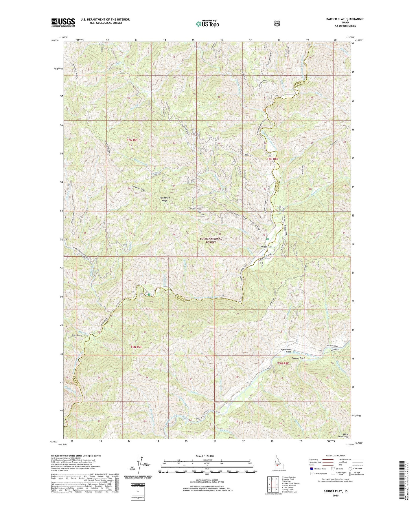
Barber Flat Idaho US Topo Map
Couldn't load pickup availability
Also explore the Barber Flat Forest Service Topo of this same quad for updated USFS data
2023 topographic map quadrangle Barber Flat in the state of Idaho. Scale: 1:24000. Based on the newly updated USGS 7.5' US Topo map series, this map is in the following counties: Boise, Elmore. The map contains contour data, water features, and other items you are used to seeing on USGS maps, but also has updated roads and other features. This is the next generation of topographic maps. Printed on high-quality waterproof paper with UV fade-resistant inks.
Quads adjacent to this one:
West: Rabbit Creek Summit
Northwest: Sunset Mountain
North: Big Owl Creek
Northeast: Bear River
East: Grand Mountain
Southeast: Little Trinity Lake
South: Sheep Creek
Southwest: Twin Springs
This map covers the same area as the classic USGS quad with code o43115g5.
Contains the following named places: Alexander Creek, Alexander Flats, Barber Flat, Barber Flat Forest Service Station, Beaver Creek, Big Five Creek, Black Rock Campground, Blind Creek, Boise Mountains, Camp Creek, Corral Creek, Crooked River, Dobson Gulch, Don Creek, Fire Creek, First Creek, Hungarian Creek, Hungarian Ridge, Idaho Outdoor Assn Campground, Lost Creek, Meadow Creek, Ninemeyer Campground, Ninemeyer Creek, Plantation Creek, Pool Creek, Rabbit Creek, Road Creek, Sacrifice Creek, Second Creek, Short Creek, Simmons Creek, Tin Cup Creek, Weatherby Landing Area, Wood Creek, Wren Creek