
MyTopo
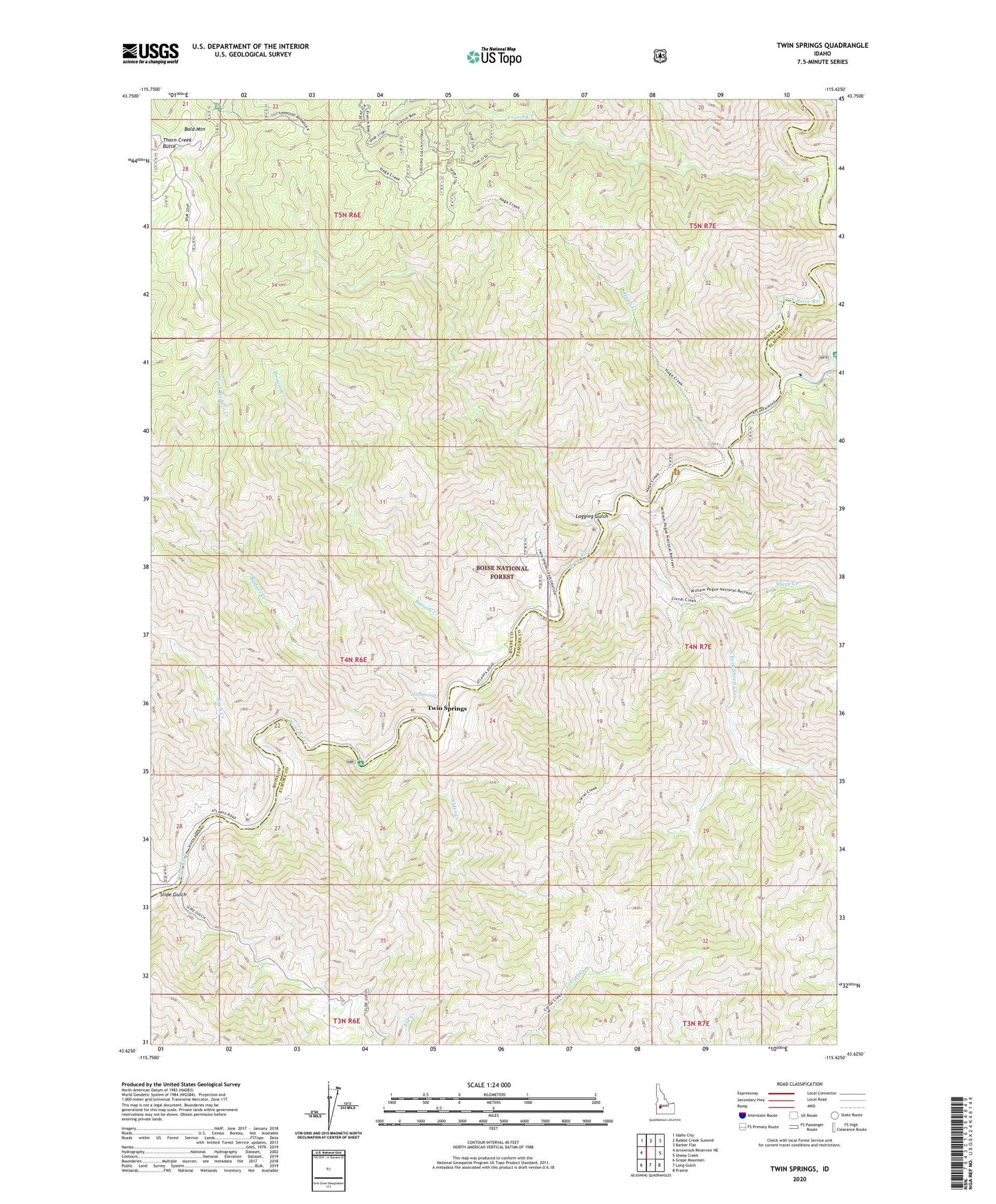
Twin Springs Idaho US Topo Map
Couldn't load pickup availability
Also explore the Twin Springs Forest Service Topo of this same quad for updated USFS data
2023 topographic map quadrangle Twin Springs in the state of Idaho. Scale: 1:24000. Based on the newly updated USGS 7.5' US Topo map series, this map is in the following counties: Boise, Elmore. The map contains contour data, water features, and other items you are used to seeing on USGS maps, but also has updated roads and other features. This is the next generation of topographic maps. Printed on high-quality waterproof paper with UV fade-resistant inks.
Quads adjacent to this one:
West: Arrowrock Reservoir NE
Northwest: Idaho City
North: Rabbit Creek Summit
Northeast: Barber Flat
East: Sheep Creek
Southeast: Prairie
South: Long Gulch
Southwest: Grape Mountain
This map covers the same area as the classic USGS quad with code o43115f6.
Contains the following named places: Alder Creek, Badger Creek, Badger Creek Recreation Site, Bald Mountain, Bald Mountain Campground, Birch Creek, Birch Creek Campground, Browns Creek, French Creek, Haga Creek, Hot Springs, Logging Gulch, Middle Fork Boise River, North Fork Badger Creek, North Fork Boise River, Rough Creek, Sheep Creek, Slide Gulch, South Fork Sheep Creek, Troutdale Campground, Troutdale Guard Station, Twin Springs, Twinsprings Post Office


