MyTopo
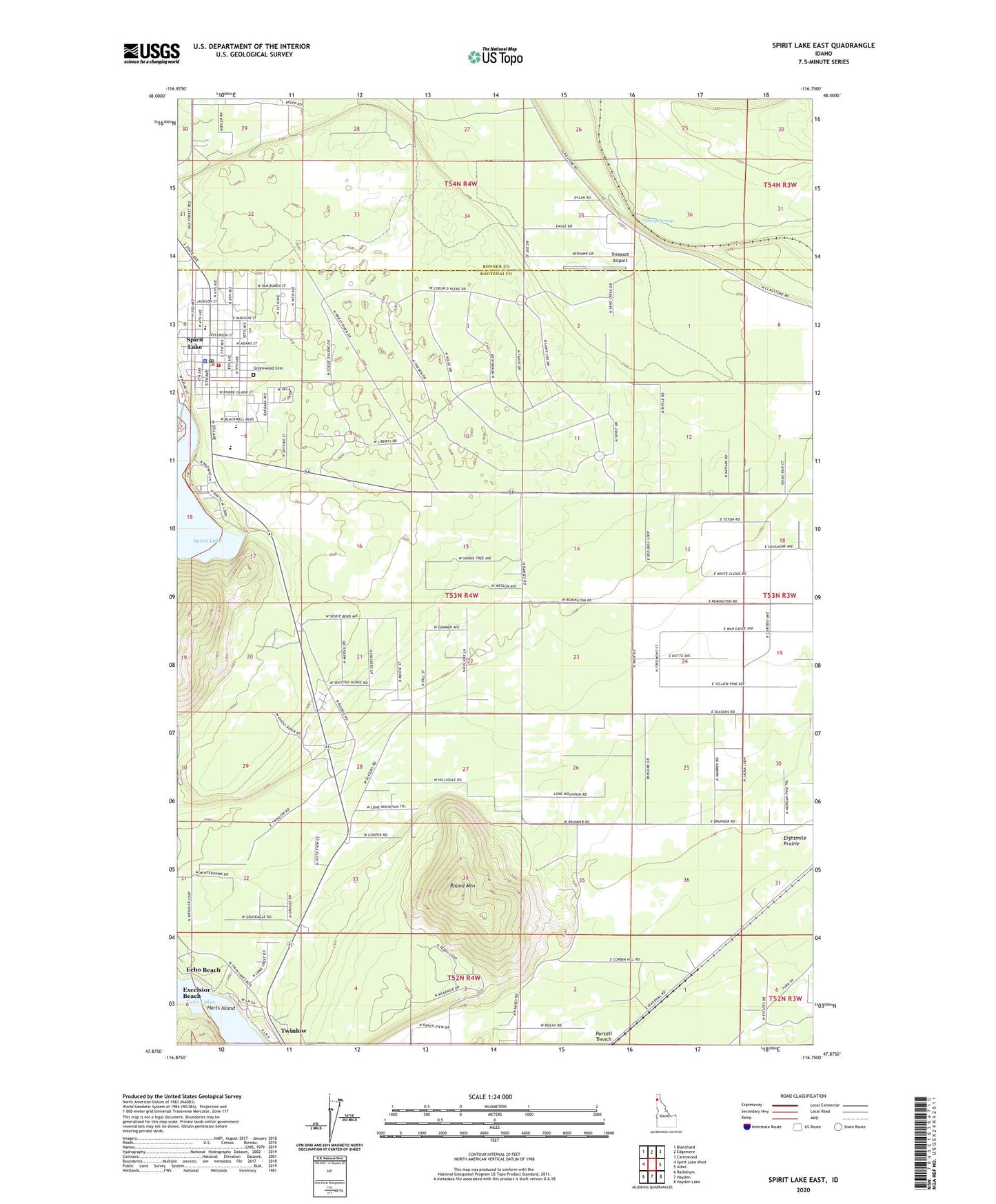
Spirit Lake East Idaho US Topo Map
Couldn't load pickup availability
Also explore the Spirit Lake East Forest Service Topo of this same quad for updated USFS data
2024 topographic map quadrangle Spirit Lake East in the state of Idaho. Scale: 1:24000. Based on the newly updated USGS 7.5' US Topo map series, this map is in the following counties: Kootenai, Bonner. The map contains contour data, water features, and other items you are used to seeing on USGS maps, but also has updated roads and other features. This is the next generation of topographic maps. Printed on high-quality waterproof paper with UV fade-resistant inks.
Quads adjacent to this one:
West: Spirit Lake West
Northwest: Blanchard
North: Edgemere
Northeast: Careywood
East: Athol
Southeast: Hayden Lake
South: Hayden
Southwest: Rathdrum
This map covers the same area as the classic USGS quad with code o47116h7.
Contains the following named places: City of Spirit Lake, Greenwood Cemetery, Harts Island, Lakewood School, Round Mountain, Round Mountain Aerodrome, Sheep Springs, Spirit Lake, Spirit Lake Access, Spirit Lake Elementary School, Spirit Lake Fire District Station 1, Spirit Lake Police Department, Spirit Lake Post Office, Treeport Airport, Twinlow