MyTopo
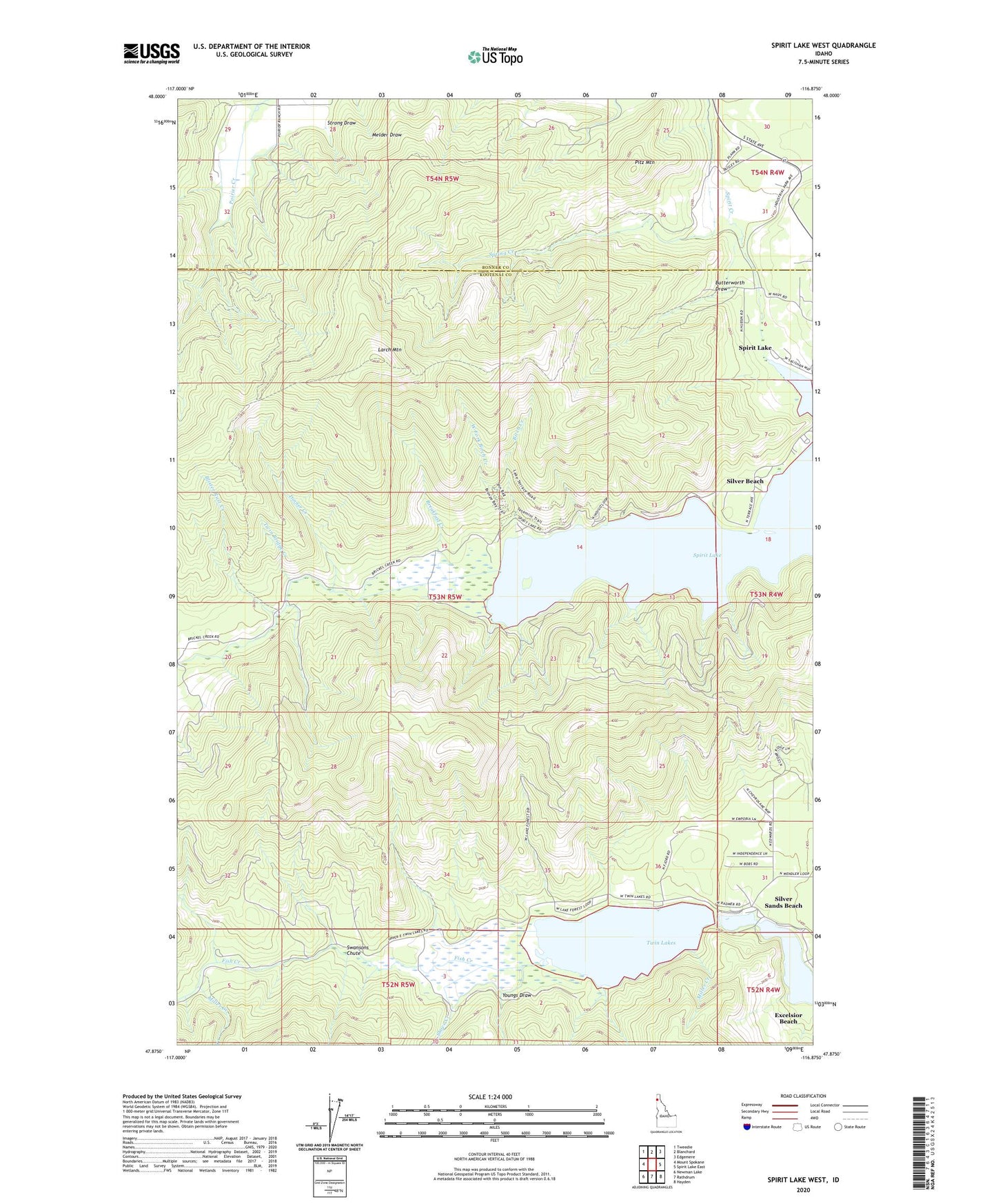
Spirit Lake West Idaho US Topo Map
Couldn't load pickup availability
Also explore the Spirit Lake West Forest Service Topo of this same quad for updated USFS data
2024 topographic map quadrangle Spirit Lake West in the state of Idaho. Scale: 1:24000. Based on the newly updated USGS 7.5' US Topo map series, this map is in the following counties: Kootenai, Bonner. The map contains contour data, water features, and other items you are used to seeing on USGS maps, but also has updated roads and other features. This is the next generation of topographic maps. Printed on high-quality waterproof paper with UV fade-resistant inks.
Quads adjacent to this one:
West: Mount Spokane
Northwest: Tweedie
North: Blanchard
Northeast: Edgemere
East: Spirit Lake East
Southeast: Hayden
South: Rathdrum
Southwest: Newman Lake
This map covers the same area as the classic USGS quad with code o47116h8.
Contains the following named places: Birch Creek, Blister Rust Creek, Breakfast Creek, Butterworth Draw, Dinner Creek, Echo Beach, Excelsior Beach, Fir Grove, Fish Creek, Larch Mountain, Miller Creek, Pitz Mountain, Shove Creek, Silver Beach, Silver Sands Beach, Spirit Lake, Spirit Pines Church Camp, Spring Creek, Strong Draw, Swansons Chute, Twin Bridge Creek, Twin Lakes, Twin Lakes Access, West Fork Birch Creek, Youngs Draw, ZIP Code: 83869