MyTopo
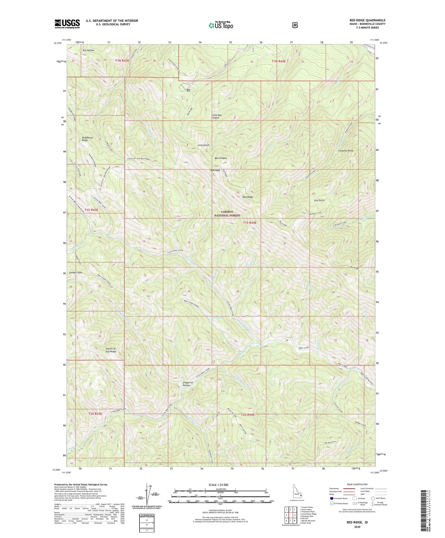
Red Ridge Idaho US Topo Map
Couldn't load pickup availability
Also explore the Red Ridge Forest Service Topo of this same quad for updated USFS data
2024 topographic map quadrangle Red Ridge in the state of Idaho. Scale: 1:24000. Based on the newly updated USGS 7.5' US Topo map series, this map is in the following counties: Bonneville. The map contains contour data, water features, and other items you are used to seeing on USGS maps, but also has updated roads and other features. This is the next generation of topographic maps. Printed on high-quality waterproof paper with UV fade-resistant inks.
Quads adjacent to this one:
West: Commissary Ridge
Northwest: Conant Valley
North: Swan Valley
Northeast: Thompson Peak
East: Palisades Dam
Southeast: Poker Peak
South: Big Elk Mountain
Southwest: Herman
This map covers the same area as the classic USGS quad with code o43111c3.
Contains the following named places: Camp Creek, Camp Ta-Man-a-Wis, Chaparral Creek, Chaparral Hollow, Congress Knob, Currant Creek, Currant Creek Guard Station, Deadhorse Ridge, Deadman Creek, Deer Creek, Golden Gate, Milk Creek, North Fork Bear Creek, Poison Creek, Red Peak, Red Ridge, Small Creek, Warm Springs Creek, White Spring