MyTopo
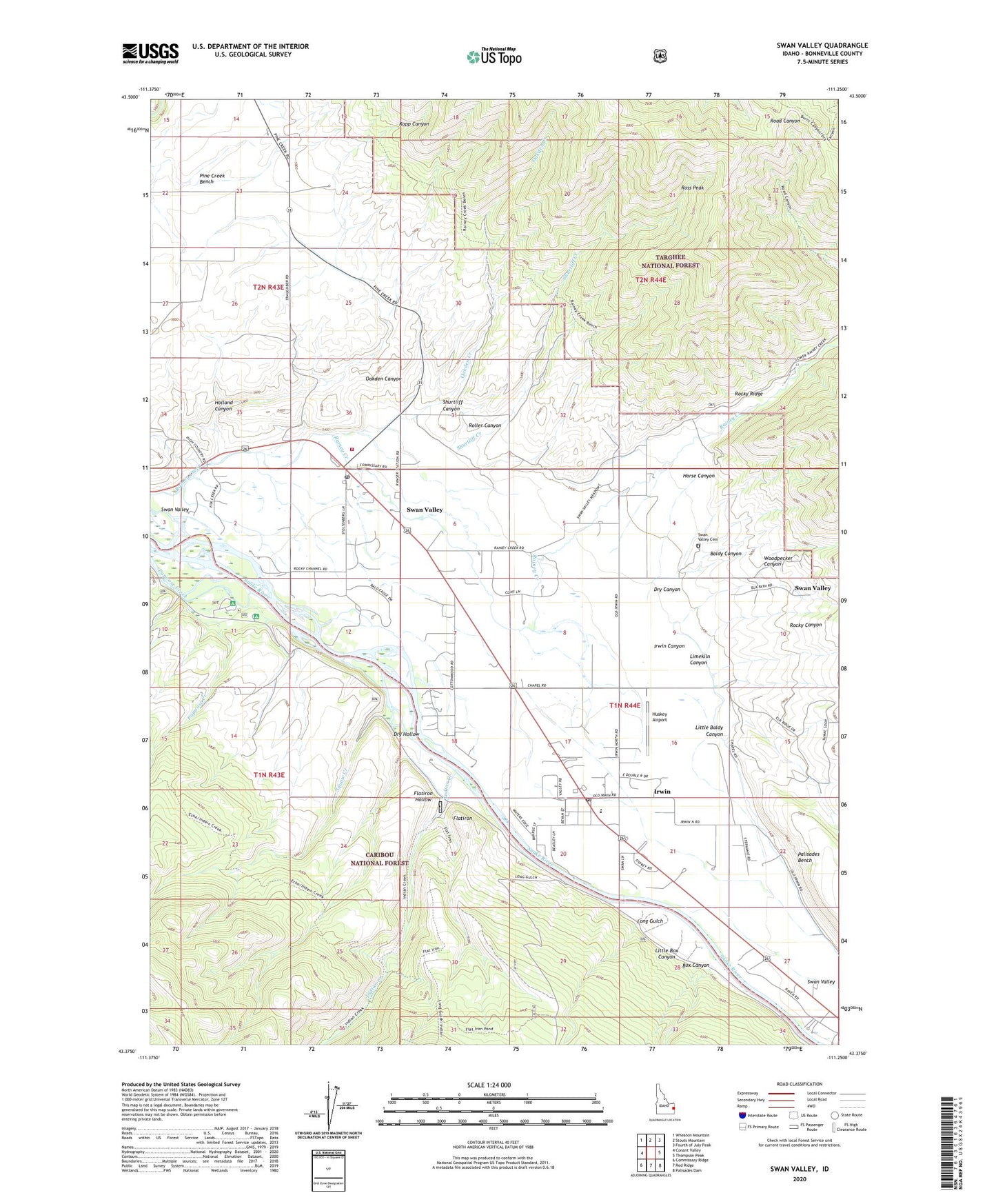
Swan Valley Idaho US Topo Map
Couldn't load pickup availability
Also explore the Swan Valley Forest Service Topo of this same quad for updated USFS data
2024 topographic map quadrangle Swan Valley in the state of Idaho. Scale: 1:24000. Based on the newly updated USGS 7.5' US Topo map series, this map is in the following counties: Bonneville. The map contains contour data, water features, and other items you are used to seeing on USGS maps, but also has updated roads and other features. This is the next generation of topographic maps. Printed on high-quality waterproof paper with UV fade-resistant inks.
Quads adjacent to this one:
West: Conant Valley
Northwest: Wheaton Mountain
North: Stouts Mountain
Northeast: Fourth of July Peak
East: Thompson Peak
Southeast: Palisades Dam
South: Red Ridge
Southwest: Commissary Ridge
This map covers the same area as the classic USGS quad with code o43111d3.
Contains the following named places: Baldy Canyon, Box Canyon, ChapelInThe Valley, City of Irwin, City of Swan Valley, Dry Canyon, Dry Hollow, Falls Campground, Flatiron, Flatiron Hollow, Holland Canyon, Horse Canyon, Huskey Airport, Indian Creek, Irwin, Irwin Canyon, Irwin Post Office, Kopp Canyon, Limekiln Canyon, Little Baldy Canyon, Little Box Canyon, Long Gulch, Oakden Canyon, Oakden Creek, Palisades Creek Winter Range Wildlife Habitate Area, Papoose Creek, Roller Canyon, Ross Peak, Shurtliff Canyon, Shurtliff Creek, Squaw Creek, Swan Valley, Swan Valley Cemetery, Swan Valley Elementary School, Swan Valley Fire District 2, Swan Valley Post Office, Swan Valley Ranger Station, Woodpecker Canyon