
MyTopo
Conant Valley Idaho US Topo Map
Couldn't load pickup availability
Also explore the Conant Valley Forest Service Topo of this same quad for updated USFS data
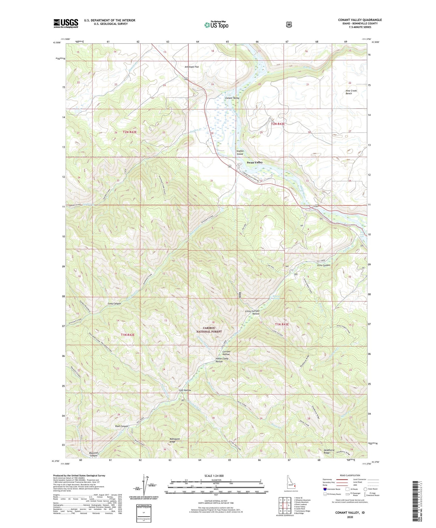
2024 topographic map quadrangle Conant Valley in the state of Idaho. Scale: 1:24000. Based on the newly updated USGS 7.5' US Topo map series, this map is in the following counties: Bonneville. The map contains contour data, water features, and other items you are used to seeing on USGS maps, but also has updated roads and other features. This is the next generation of topographic maps. Printed on high-quality waterproof paper with UV fade-resistant inks.
Quads adjacent to this one:
West: Point Lookout
Northwest: Heise SE
North: Wheaton Mountain
Northeast: Stouts Mountain
East: Swan Valley
Southeast: Red Ridge
South: Commissary Ridge
Southwest: Castle Rock
This map covers the same area as the classic USGS quad with code o43111d4.
Contains the following named places: Blacktail Canyon, Calf Hollow, Conant Valley, Currant Hollow, Echo Canyon, Echo Creek, Fall Creek, Fall Creek Falls, Garden Creek, Granite Creek, Granite Creek Dam, Horse Creek, Indian Camp Creek, Indian Camp Hollow, Little Currant Hollow, Long Canyon, Mineral Springs, Pine Creek, Pine Creek Bench, Porcupine Creek, Pritchard Creek, Rainey Creek, Rash Canyon, Sawmill Creek, Snake River Ranger Station, South Fork Fall Creek, Spring Creek Campground, Staffel Island, Toliver Dam


