MyTopo
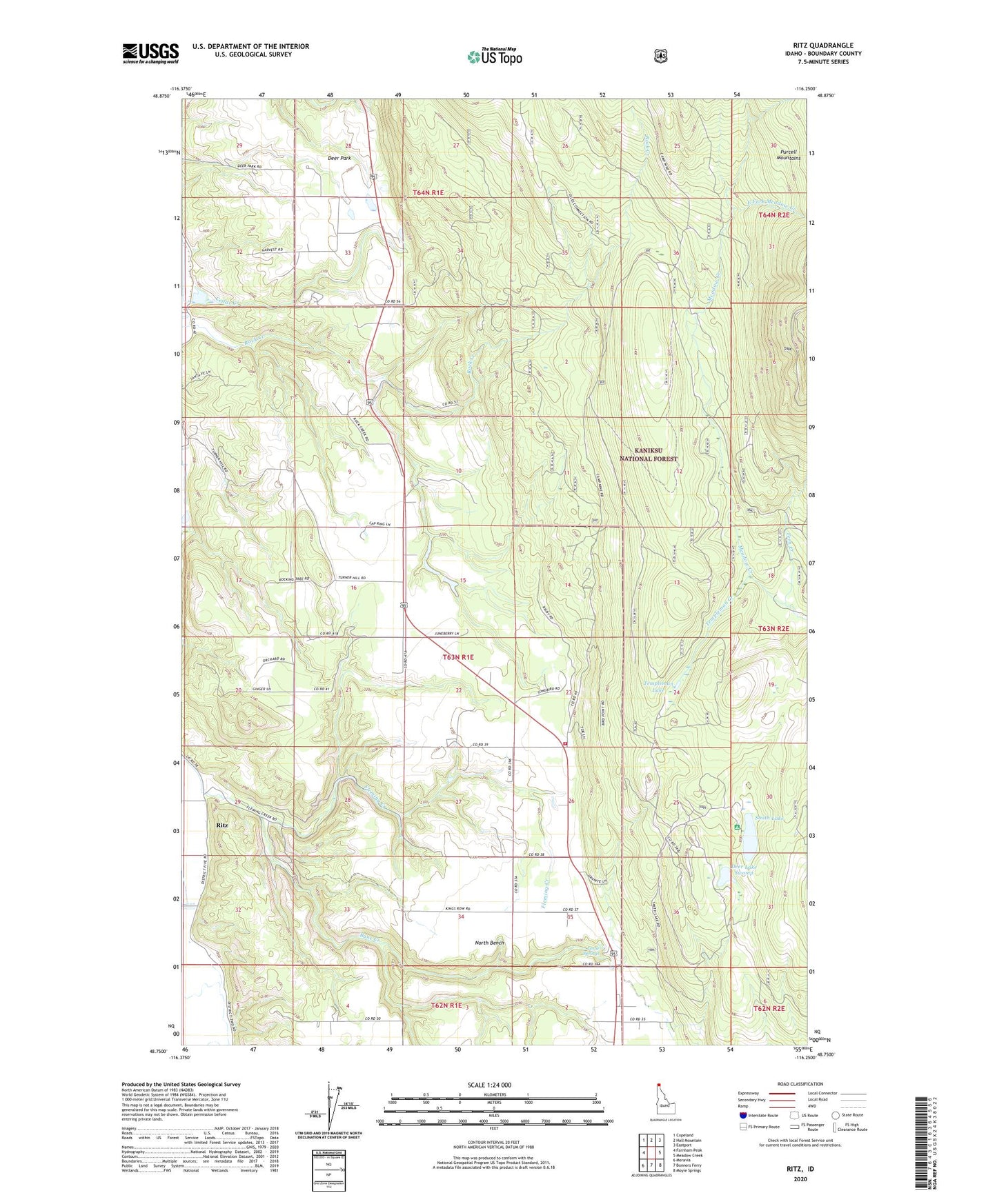
Ritz Idaho US Topo Map
Couldn't load pickup availability
Also explore the Ritz Forest Service Topo of this same quad for updated USFS data
2024 topographic map quadrangle Ritz in the state of Idaho. Scale: 1:24000. Based on the newly updated USGS 7.5' US Topo map series, this map is in the following counties: Boundary. The map contains contour data, water features, and other items you are used to seeing on USGS maps, but also has updated roads and other features. This is the next generation of topographic maps. Printed on high-quality waterproof paper with UV fade-resistant inks.
Quads adjacent to this one:
West: Farnham Peak
Northwest: Copeland
North: Hall Mountain
Northeast: Eastport
East: Meadow Creek
Southeast: Moyie Springs
South: Bonners Ferry
Southwest: Moravia
This map covers the same area as the classic USGS quad with code o48116g3.
Contains the following named places: Ansley Dam, Bane Creek, Bonners Ferry Division, Camp Nine, Deer Lake Swamp, Deer Park, Deer Park Community Hall, DeVoignes Spur, East Fork Meadow Creek, Fern Creek, Leslie Springs, Nixon Number One Dam, Nixon Number Two Dam, North Bench, North Bench Fire Department Station 2, Regal Mine, Ritz, Smith Lake, Smith Lake Campground, Templeman Creek, Templeman Lake, Watson Spur