MyTopo
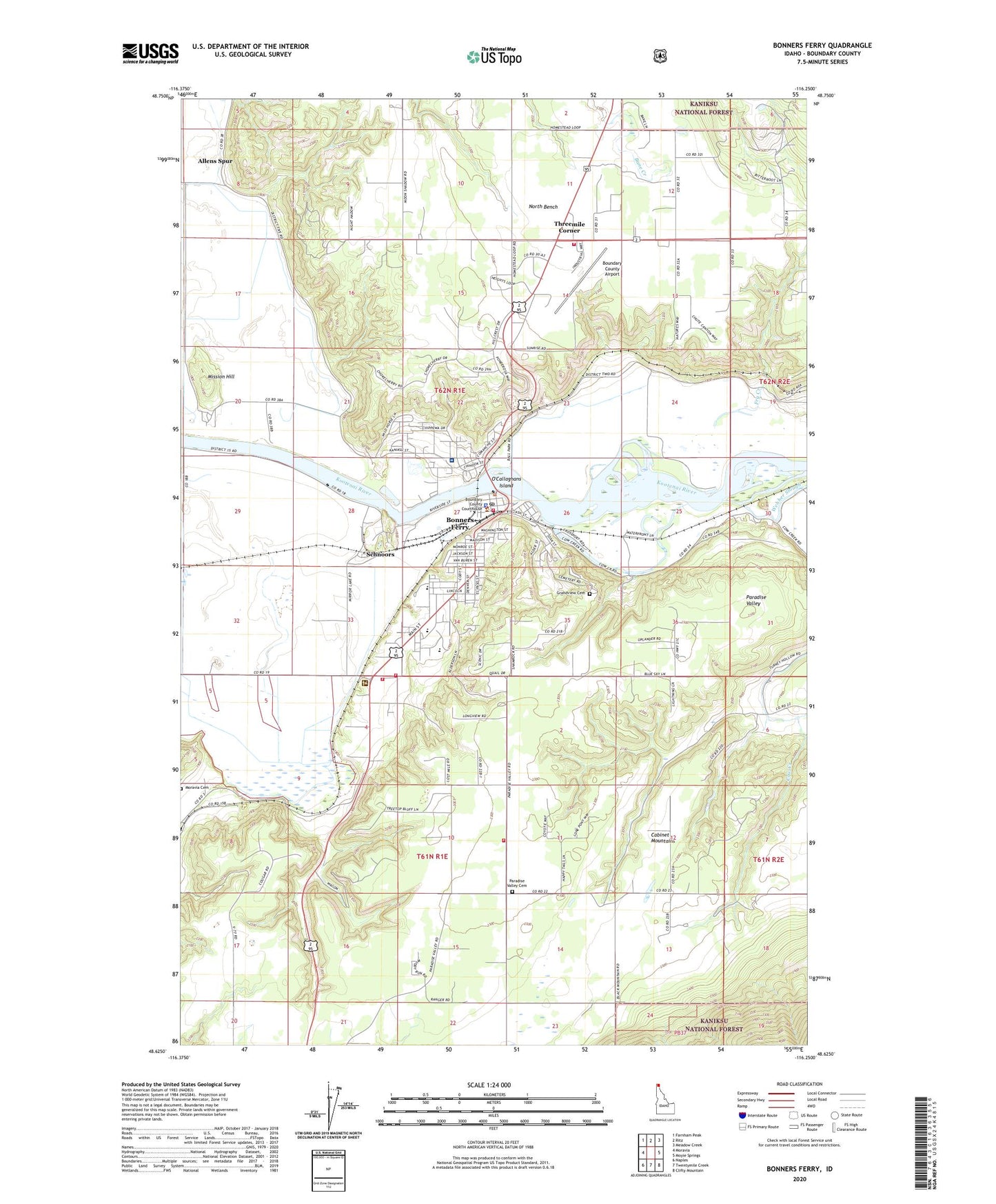
Bonners Ferry Idaho US Topo Map
Couldn't load pickup availability
Also explore the Bonners Ferry Forest Service Topo of this same quad for updated USFS data
2024 topographic map quadrangle Bonners Ferry in the state of Idaho. Scale: 1:24000. Based on the newly updated USGS 7.5' US Topo map series, this map is in the following counties: Boundary. The map contains contour data, water features, and other items you are used to seeing on USGS maps, but also has updated roads and other features. This is the next generation of topographic maps. Printed on high-quality waterproof paper with UV fade-resistant inks.
Quads adjacent to this one:
West: Moravia
Northwest: Farnham Peak
North: Ritz
Northeast: Meadow Creek
East: Moyie Springs
Southeast: Clifty Mountain
South: Twentymile Creek
Southwest: Naples
This map covers the same area as the classic USGS quad with code o48116f3.
Contains the following named places: Allens Spur, Bonners Ferry, Bonners Ferry Fire Department Station 1, Bonners Ferry Fire Department Station 2, Bonners Ferry High School, Bonners Ferry Police Department, Bonners Ferry Post Office, Bonners Ferry Ranger Station, Bonners Ferry Substation, Boundary Community Hospital, Boundary County Airport, Boundary County Middle School, Boundary County Sheriff's Office, Brush Creek, City of Bonners Ferry, Erickson Dam, Fry Creek, Grandview Cemetery, Indian Mission, KBFI-AM (Bonners Ferry), Kootenai Valley Forest Protection District, Mission Hill, Moravia Cemetery, North Bench Fire Department, North Side School, O'Callaghans Island, Paradise Valley Cemetery, Paradise Valley Fire Department, Praise Church Christian Academy, Rocky Mountain Academy, Schnoors, Threemile Corner, Valley View Elementary School, Webber Slough