MyTopo
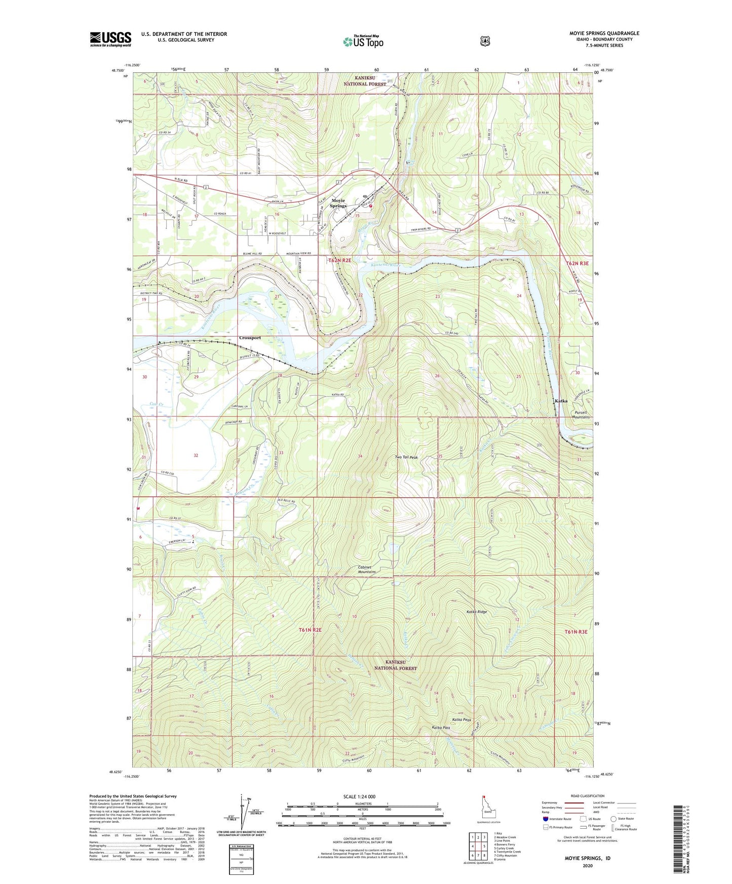
Moyie Springs Idaho US Topo Map
Couldn't load pickup availability
Also explore the Moyie Springs Forest Service Topo of this same quad for updated USFS data
2024 topographic map quadrangle Moyie Springs in the state of Idaho. Scale: 1:24000. Based on the newly updated USGS 7.5' US Topo map series, this map is in the following counties: Boundary. The map contains contour data, water features, and other items you are used to seeing on USGS maps, but also has updated roads and other features. This is the next generation of topographic maps. Printed on high-quality waterproof paper with UV fade-resistant inks.
Quads adjacent to this one:
West: Bonners Ferry
Northwest: Ritz
North: Meadow Creek
Northeast: Line Point
East: Curley Creek
Southeast: Leonia
South: Clifty Mountain
Southwest: Twentymile Creek
This map covers the same area as the classic USGS quad with code o48116f2.
Contains the following named places: Burro Ridge Trail, Cabin Creek, City of Moyie Springs, Cow Creek, Crossport, Dobson Creek, Evergreen Elementary School, Katka, Katka Creek, Katka Pass, Katka Peak, Katka Ridge, Moyie Dam, Moyie Falls, Moyie River, Moyie Springs, Moyie Springs Fire Department, Moyie Springs Post Office, Paradise Valley Fire District, Sheridan School, Two Tail Peak