
MyTopo
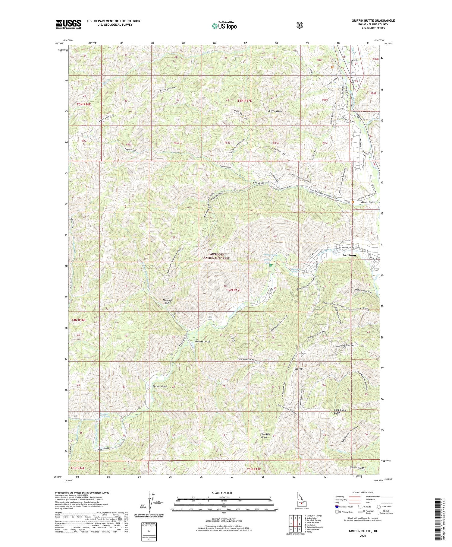
Griffin Butte Idaho US Topo Map
Couldn't load pickup availability
Also explore the Griffin Butte Forest Service Topo of this same quad for updated USFS data
2024 topographic map quadrangle Griffin Butte in the state of Idaho. Scale: 1:24000. Based on the newly updated USGS 7.5' US Topo map series, this map is in the following counties: Blaine. The map contains contour data, water features, and other items you are used to seeing on USGS maps, but also has updated roads and other features. This is the next generation of topographic maps. Printed on high-quality waterproof paper with UV fade-resistant inks.
Quads adjacent to this one:
West: Boyle Mountain
Northwest: Easley Hot Springs
North: Amber Lakes
Northeast: Rock Roll Canyon
East: Sun Valley
Southeast: Hailey
South: Mahoney Butte
Southwest: Buttercup Mountain
This map covers the same area as the classic USGS quad with code o43114f4.
Contains the following named places: Adams Gulch, Alturas Gulch, Bald Mountain, Bassett Gulch, Cottonwood Campground, Dip Creek, Dollar Lake, Eve Gulch, Griffin Butte, Guyer Hot Springs, KECH-FM (Sun Valley), Ketchum Fire Department Station 3, KSKI-FM (Sun Valley), Lake Creek, Moonlight Gulch, Penny Lake, Red Warrior Creek, Warfield Hot Spring, Warm Springs Campground, Warm Springs Creek, West Fork Warm Springs Creek


