MyTopo
Sun Valley Idaho US Topo Map
Couldn't load pickup availability
Also explore the Sun Valley Forest Service Topo of this same quad for updated USFS data
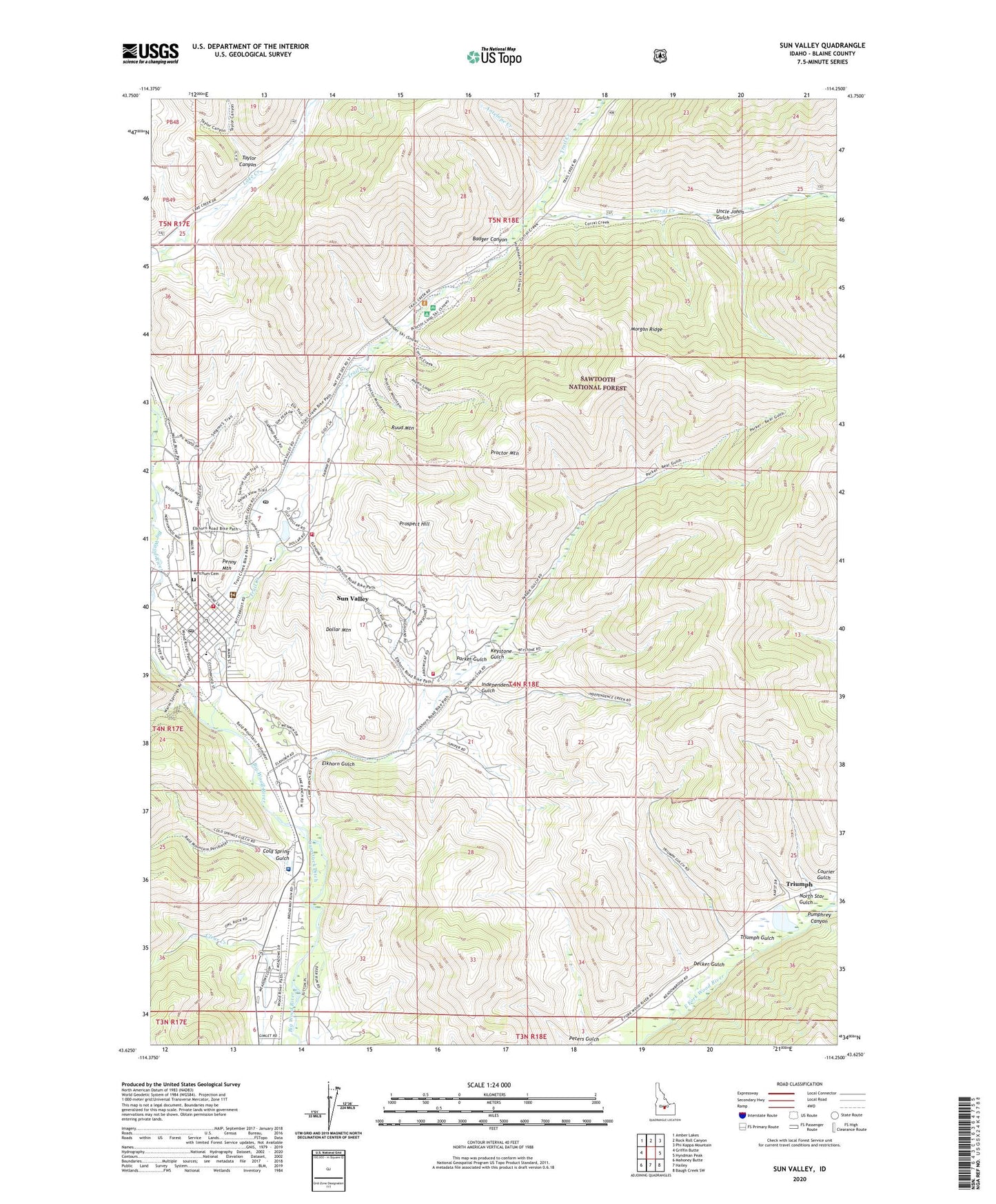
2024 topographic map quadrangle Sun Valley in the state of Idaho. Scale: 1:24000. Based on the newly updated USGS 7.5' US Topo map series, this map is in the following counties: Blaine. The map contains contour data, water features, and other items you are used to seeing on USGS maps, but also has updated roads and other features. This is the next generation of topographic maps. Printed on high-quality waterproof paper with UV fade-resistant inks.
Quads adjacent to this one:
West: Griffin Butte
Northwest: Amber Lakes
North: Rock Roll Canyon
Northeast: Phi Kappa Mountain
East: Hyndman Peak
Southeast: Baugh Creek SW
South: Hailey
Southwest: Mahoney Butte
This map covers the same area as the classic USGS quad with code o43114f3.
Contains the following named places: Amicus Mine, Antelope Creek, Badger Canyon, Boundary Campground, City of Ketchum, City of Sun Valley, Clear Creek, Cold Spring Gulch, Colonnade Mall, Corral Creek, Courier Gulch, Courier Mine, Decker Gulch, Dollar Mountain, Elkhorn Gulch, Elkhorn Village, Ernest Hemingway Elementary, Giacobbi Square, Hyndman Creek, Independence Gulch, Independence Mine, June Day Mine, Ketchum, Ketchum Cemetery, Ketchum Fire Department Station 1, Ketchum Police Department, Ketchum Post Office, Keystone Gulch, Montgomery Mine, Morgan Ridge, North Star Gulch, North Star Mine, Old Triumph Mine, Parker Gulch, Parker Mine, Penny Mountain, Peters Gulch, Pierce Tunnel, Proctor Mountain, Prospect Hill, Pumphrey Canyon, Ruud Mountain, Saint Louis Mine, Saint Luke's Wood River Medical Center, Sun Valley, Sun Valley Fire Department, Sun Valley Fire Department Elkhorn Station, Sun Valley jPost Office, Sun Valley Police Department, Sun Valley Post Office, Sun Valley Village, Taylor Canyon, Trail Creek, Trail Creek Dam, Triumph, Triumph Gulch, Triumph Mine, Uncle Johns Gulch, ZIP Codes: 83353, 83354