MyTopo
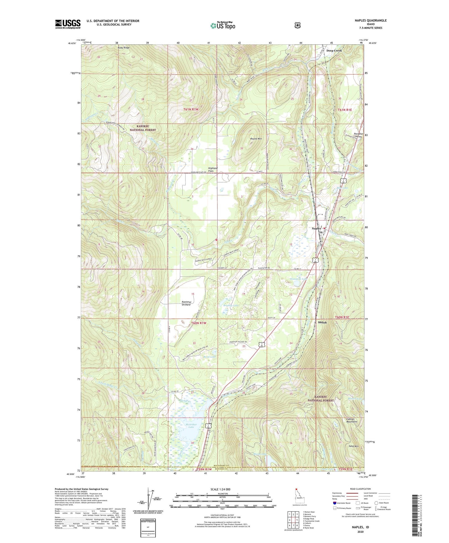
Naples Idaho US Topo Map
Couldn't load pickup availability
Also explore the Naples Forest Service Topo of this same quad for updated USFS data
2024 topographic map quadrangle Naples in the state of Idaho. Scale: 1:24000. Based on the newly updated USGS 7.5' US Topo map series, this map is in the following counties: Boundary, Bonner. The map contains contour data, water features, and other items you are used to seeing on USGS maps, but also has updated roads and other features. This is the next generation of topographic maps. Printed on high-quality waterproof paper with UV fade-resistant inks.
Quads adjacent to this one:
West: Dodge Peak
Northwest: Roman Nose
North: Moravia
Northeast: Bonners Ferry
East: Twentymile Creek
Southeast: Wylie Knob
South: Elmira
Southwest: Colburn
This map covers the same area as the classic USGS quad with code o48116e4.
Contains the following named places: Bloom Lake, Blue Lake, Bond Lake, Bradley Lake, Brown Creek, Deep Creek, Deep Creek Access Area, Deep Creek Campground, Deep Creek Picnic Area, Dodge Creek, Fall Creek, Gold Creek, Highland Creek, Highland Flats, Highland Flats Community Hall, Kootenai Orchard, Mc Arthur, McArthur Dam, McArthur Lake, McArthur Lake Access, McArthur Wildlife Management Area, Molar Creek, Naples, Naples Elementary School, Naples Post Office, Paradise Valley, Round Mountain, Ruby Creek, Sand Lake, Shiloh, South Boundary Fire Protection District Station 1, South Boundary Fire Protection District Station Number 3, South Fork Dodge Creek, Stampede Lake, Trail Creek, Twentymile Creek, White Creek, ZIP Code: 83847