MyTopo
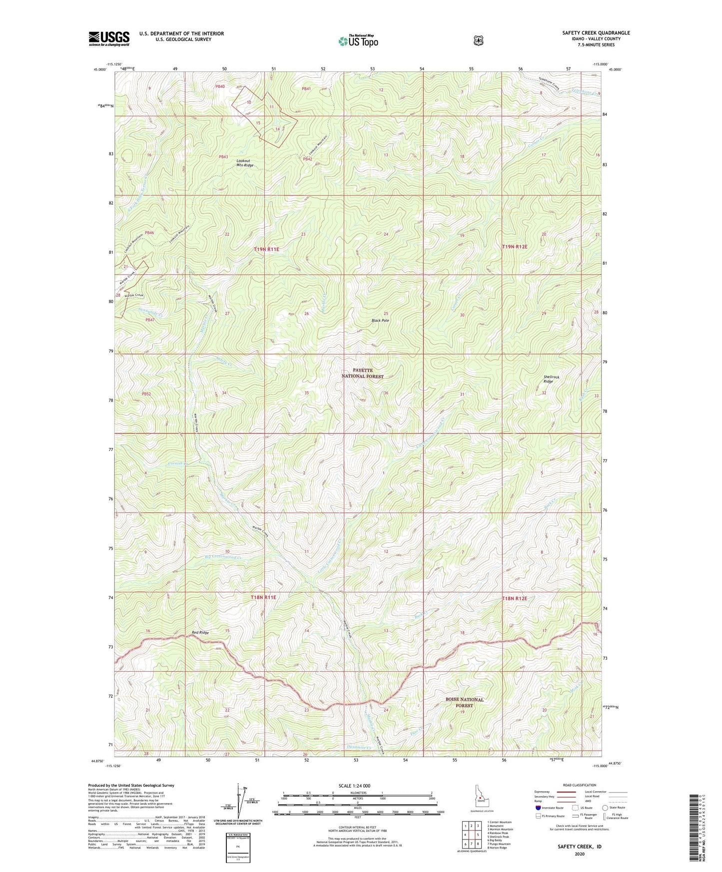
Safety Creek Idaho US Topo Map
Couldn't load pickup availability
Also explore the Safety Creek Forest Service Topo of this same quad for updated USFS data
2024 topographic map quadrangle Safety Creek in the state of Idaho. Scale: 1:24000. Based on the newly updated USGS 7.5' US Topo map series, this map is in the following counties: Valley. The map contains contour data, water features, and other items you are used to seeing on USGS maps, but also has updated roads and other features. This is the next generation of topographic maps. Printed on high-quality waterproof paper with UV fade-resistant inks.
Quads adjacent to this one:
West: Rainbow Peak
Northwest: Center Mountain
North: Monument
Northeast: Mormon Mountain
East: Shellrock Peak
Southeast: Norton Ridge
South: Pungo Mountain
Southwest: Big Baldy
This map covers the same area as the classic USGS quad with code o44115h1.
Contains the following named places: Belleco, Big Cottonwood Creek, Black Pole, Buck Creek, Cornish Creek, Dynamite Creek, Falls Creek, Fuse Creek, Little Cottonwood Creek, Safety Creek, Shellrock Ridge, Sunnyside Creek, Venable Mine