MyTopo
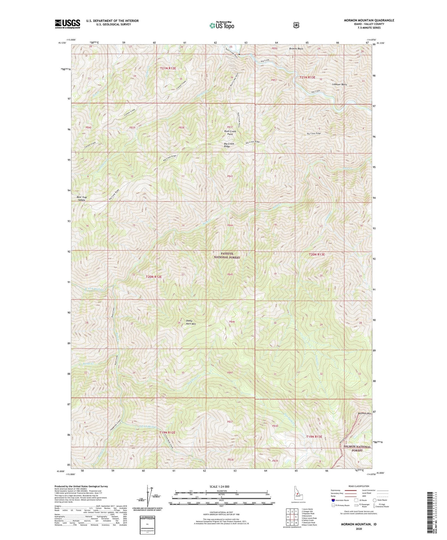
Mormon Mountain Idaho US Topo Map
Couldn't load pickup availability
Also explore the Mormon Mountain Forest Service Topo of this same quad for updated USFS data
2024 topographic map quadrangle Mormon Mountain in the state of Idaho. Scale: 1:24000. Based on the newly updated USGS 7.5' US Topo map series, this map is in the following counties: Valley. The map contains contour data, water features, and other items you are used to seeing on USGS maps, but also has updated roads and other features. This is the next generation of topographic maps. Printed on high-quality waterproof paper with UV fade-resistant inks.
Quads adjacent to this one:
West: Monument
Northwest: Acorn Butte
North: Vinegar Hill
Northeast: Papoose Peak
East: Dave Lewis Peak
Southeast: Bear Creek Point
South: Shellrock Peak
Southwest: Safety Creek
This map covers the same area as the classic USGS quad with code o45114a8.
Contains the following named places: Bear Trap Saddle, Bear Trap Saddle Trail, Browns Basin, Canyon Creek, Frank Church-River of No Return Wilderness, Lewis Creek, Lobauer Basin, Mormon Mountain, Range Creek, Rush Creek Point, Rush Creek Point Lookout, Sheep Horn Mountain, South Fork Rush Creek, Two Point Creek, West Fork Rush Creek