MyTopo
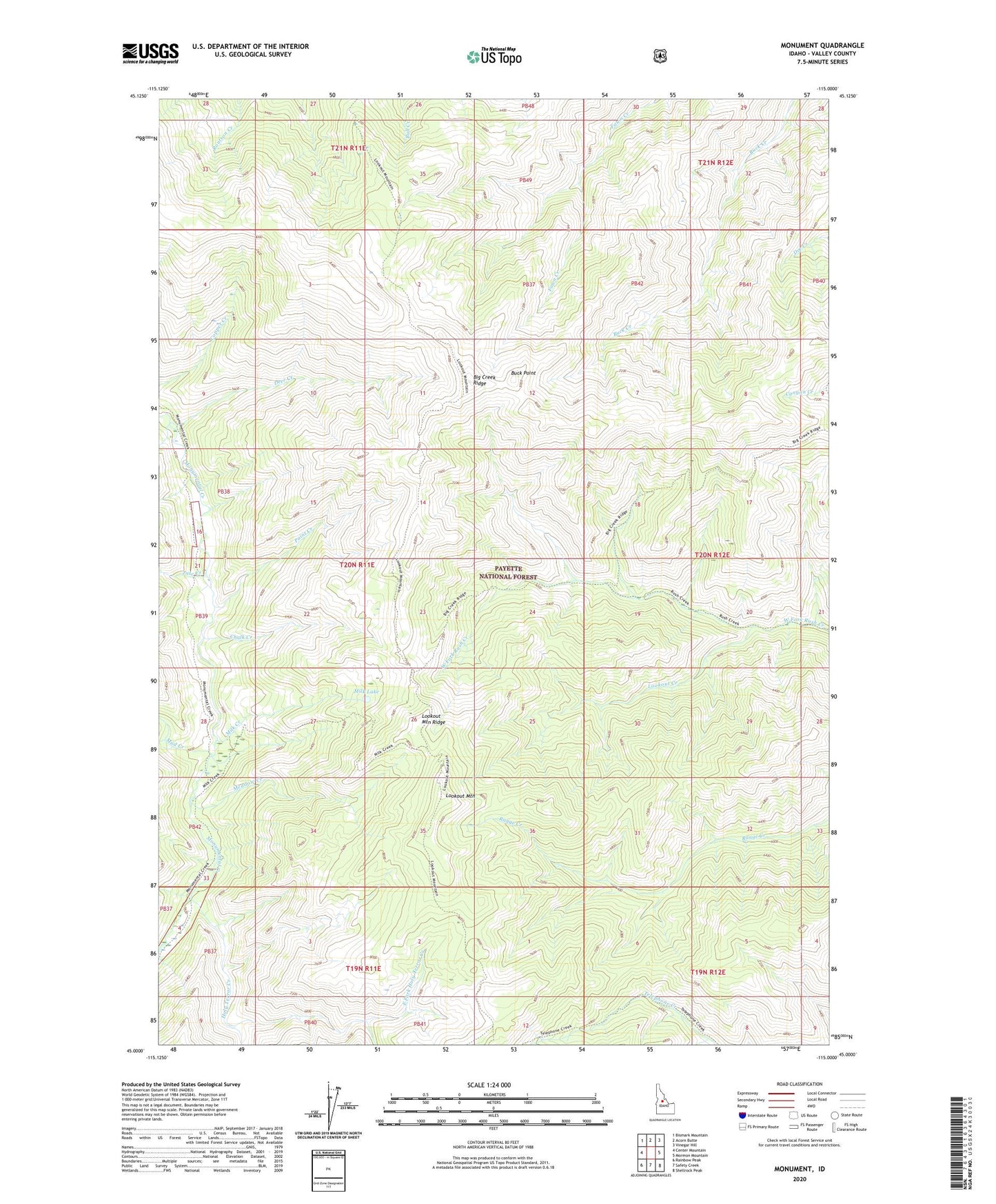
Monument Idaho US Topo Map
Couldn't load pickup availability
Also explore the Monument Forest Service Topo of this same quad for updated USFS data
2024 topographic map quadrangle Monument in the state of Idaho. Scale: 1:24000. Based on the newly updated USGS 7.5' US Topo map series, this map is in the following counties: Valley. The map contains contour data, water features, and other items you are used to seeing on USGS maps, but also has updated roads and other features. This is the next generation of topographic maps. Printed on high-quality waterproof paper with UV fade-resistant inks.
Quads adjacent to this one:
West: Center Mountain
Northwest: Bismark Mountain
North: Acorn Butte
Northeast: Vinegar Hill
East: Mormon Mountain
Southeast: Shellrock Peak
South: Safety Creek
Southwest: Rainbow Peak
This map covers the same area as the classic USGS quad with code o45115a1.
Contains the following named places: Buck Point, Chalk Creek, Deer Creek, East Fork Holy Terror Creek, Holy Terror Creek, Lookout Creek, Lookout Mountain, Lookout Mountain Ridge, Lookout Mountain Ridge Trail, Meadow Creek, Milk Creek, Milk Creek Trail, Milk Lake, Mud Creek, Paint Creek, Slide Creek, South Fork Holy Terror Creek, Talc Creek