MyTopo
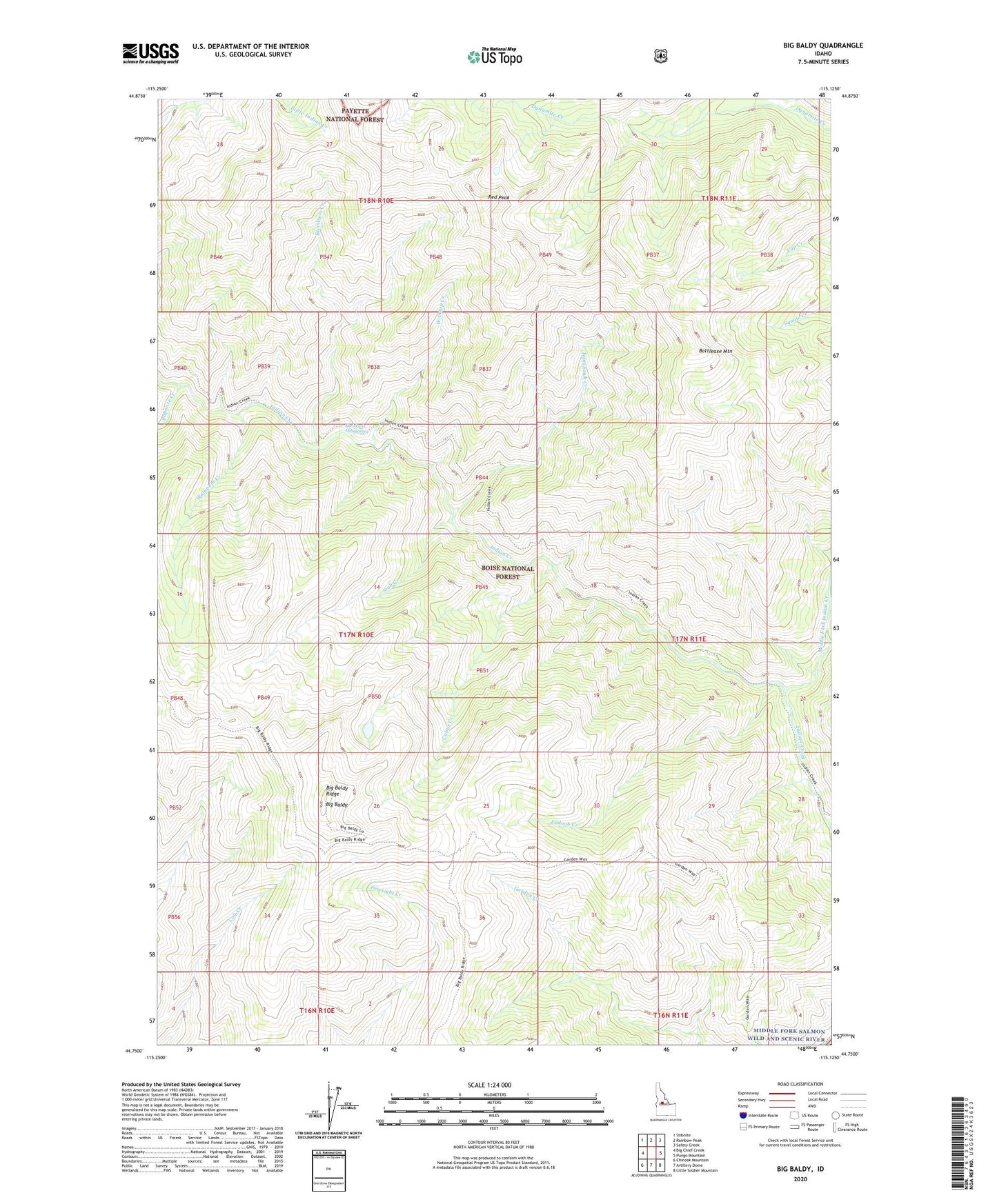
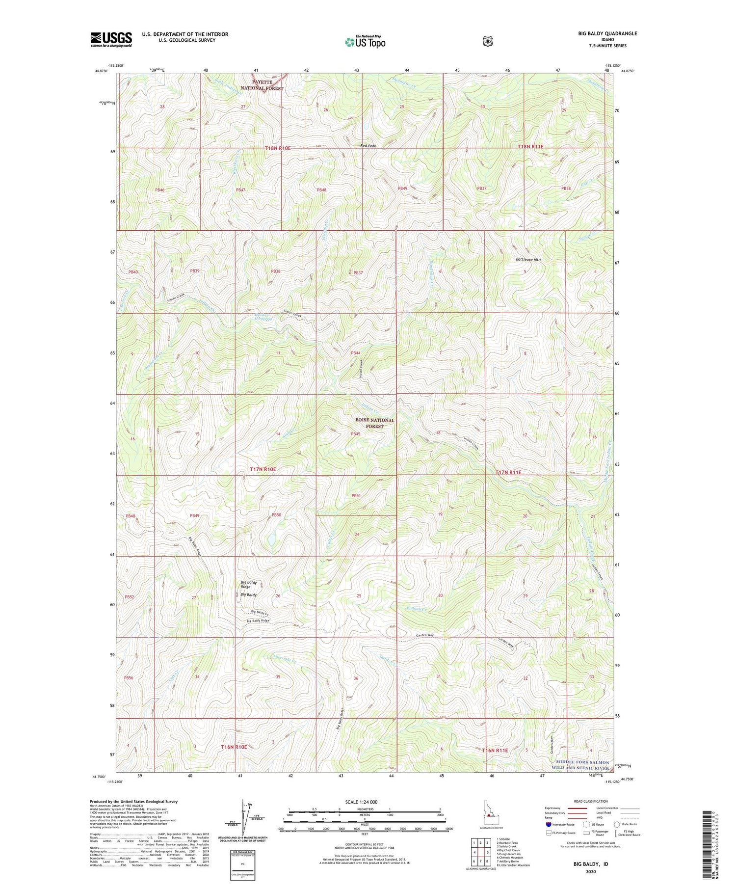
Big Baldy Idaho US Topo Map
Couldn't load pickup availability
Also explore the Big Baldy Forest Service Topo of this same quad for updated USFS data
2024 topographic map quadrangle Big Baldy in the state of Idaho. Scale: 1:24000. Based on the newly updated USGS 7.5' US Topo map series, this map is in the following counties: Valley, Custer. The map contains contour data, water features, and other items you are used to seeing on USGS maps, but also has updated roads and other features. This is the next generation of topographic maps. Printed on high-quality waterproof paper with UV fade-resistant inks.
Quads adjacent to this one:
West: Big Chief Creek
Northwest: Stibnite
North: Rainbow Peak
Northeast: Safety Creek
East: Pungo Mountain
Southeast: Little Soldier Mountain
South: Artillery Dome
Southwest: Chinook Mountain
This map covers the same area as the classic USGS quad with code o44115g2.
Contains the following named places: Battleaxe Mountain, Big Baldy, Big Baldy Ridge, Big Baldy Ridge Trail, Cultus Creek, Endoah Creek, Garden Creek Trail, Kwiskwis Creek, Kwiskwis Hot Spring, Middle Fork Indian Creek, Papoose Creek, Red Peak, Siah Creek, Tomahawk Creek, Wampum Creek, Wickiup Creek